Explore
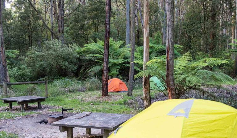
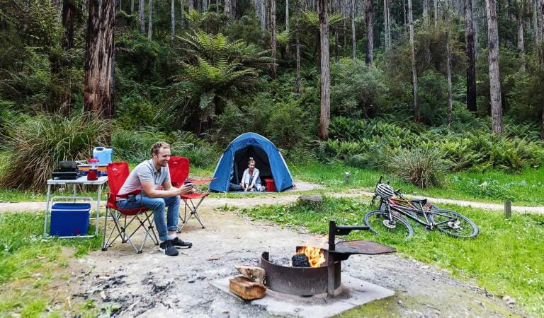
Allenvale Campground
Nestled on the banks of St George River just beyond the outskirts of Lorne, Allenvale Campground is perfectly positioned to explore the coast and the bush.
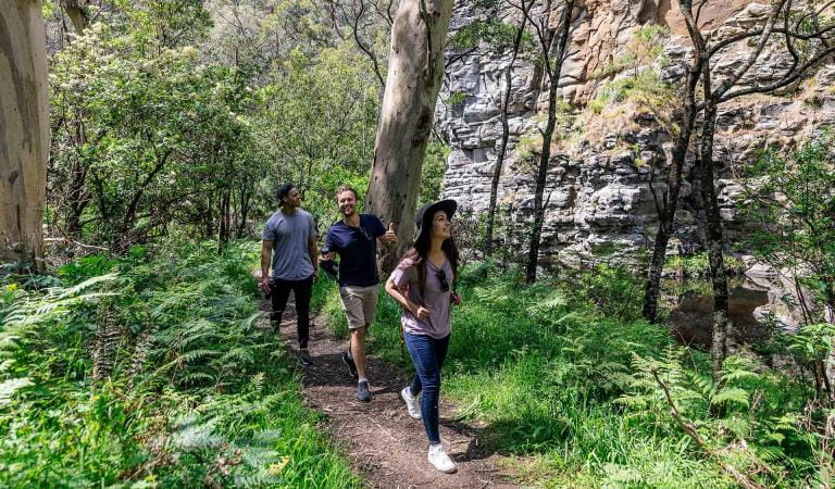
Relax at camp or explore one of the many walking trails in the area. Platypus are known to inhabit St George River, so be sure to keep an eye out at dawn and dusk.
Allenvale Campground contains 20 walk-in campsites, each accommodating up to six people. All campsites are unpowered and are suitable for tents only.
There is no direct vehicle access to the campsites. A carpark is located close by (approximately 230 meters). Campground facilities include non-flush toilets and low tables/seats.
There are no fireplaces provided, and fires are not allowed. Please bring your own fuel stove or gas barbeque for cooking.
Advanced bookings and payment are required year-round.
Changes to Great Ocean Road parks and campsites
From 1 July 2026, some parks and campsites along the Great Ocean Road will be managed by the Great Ocean Road Coast and Parks Authority (GORCAPA). Visit the GORCAPA website to see which parks GORCAPA manage.
This change is part of the transition of land management responsibilities to GORCAPA, helping support a dedicated and localised approach to managing the Great Ocean Road coast and parks.
Things To Do
Lorne
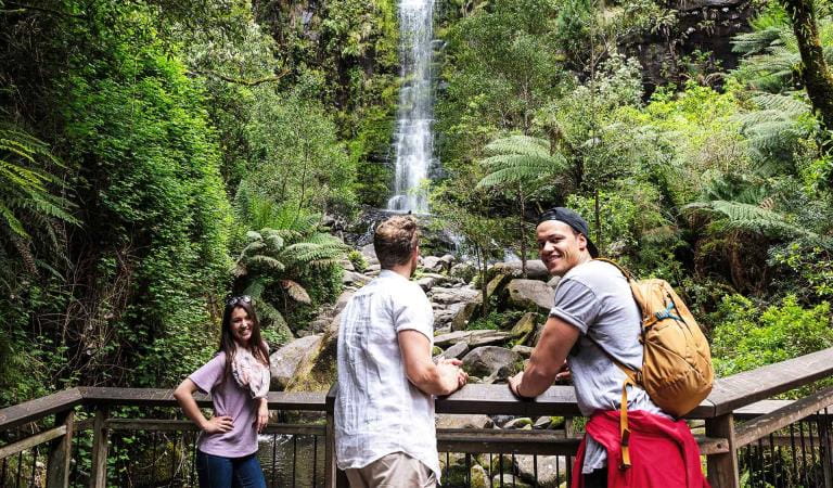
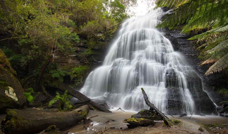
Sheoak Falls
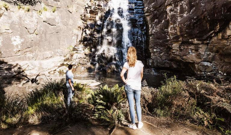
Erskine Falls
Sheoak Picnic Area
Cumberland Falls Walk
How to get there
Allenvale Campground
Allenvale Campground is located just beyond the outskirts of Lorne off Allenvale Road, approximately two hours drive from Melbourne.
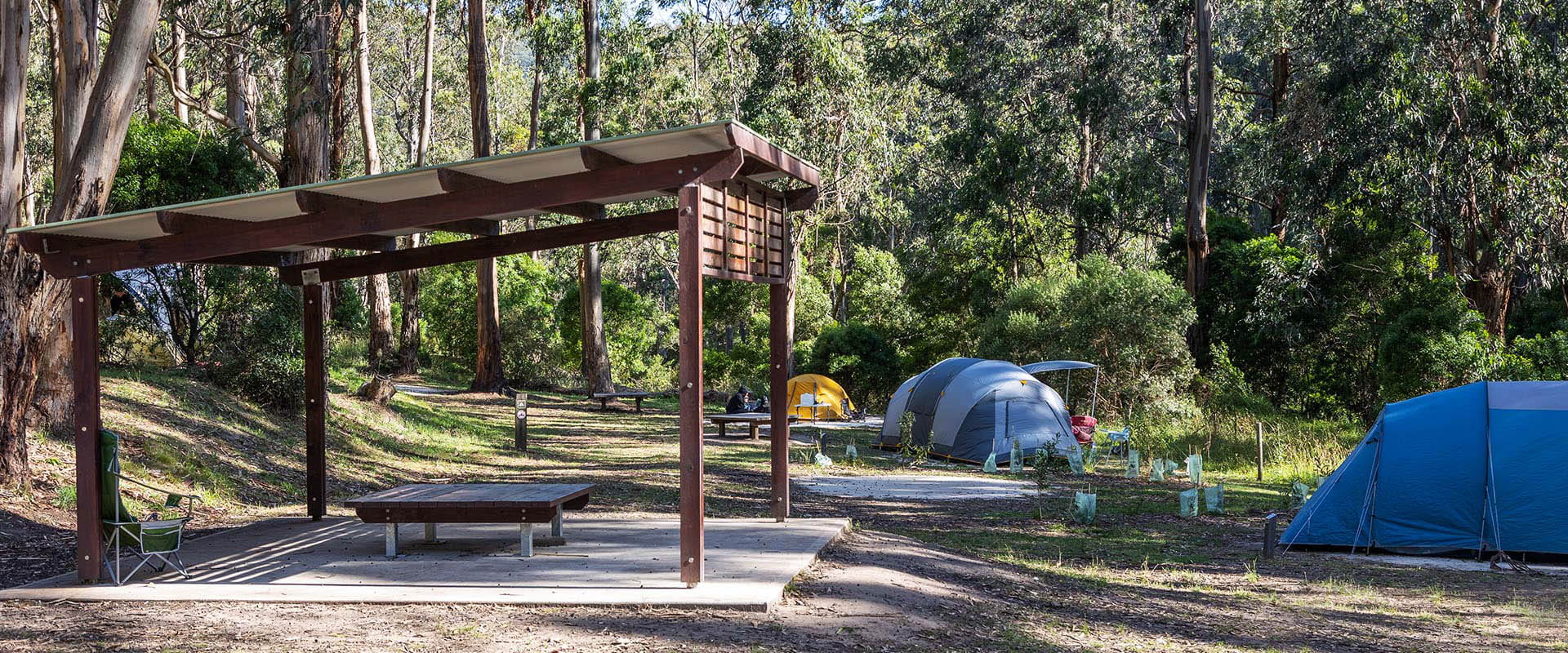
Sites
When you're there
While the campground caters for self-contained comfort, you should bring your own drinking water, and take all rubbish home with you.
There are no fireplaces, and fires are not allowed. You will need to bring your own fuel stove or gas barbecue for cooking.
Need to know
Allenvale Campground
Accessibility
Visiting a park can be more of a challenge for people with disabilities, however in Victoria there are a wide range of facilities to help people of all abilities enjoy our wonderful parks around the state.
Be prepared and stay safe
Allenvale Mill Campground is in the Great Otway National Park in the Central fire district. Bushfires can occur during the warmer months. It is your responsibility to check current and forecast weather conditions. Campfires cannot be lit on days of Total Fire Ban, however gas cookers can be used for preparing food.
Check the Fire Danger Rating and for days of Total Fire Ban at emergency.vic.gov.au, on the Vic Emergency App or call the Vic Emergency Hotline 1800 226 226.
Change of Conditions
Nature being nature, sometimes conditions can change at short notice. It’s a good idea to check this page ahead of your visit for any updates.
-
Aire River West Campground (Aire River Heritage River, Great Otway National Park GORCAPA)
Aire West Campground – Partial Seasonal Closure
Visitors are advised that sites 17–40 at Aire West Campground in Great Otway National Park are temporarily closed from 29 May to 25 September 2026 due to seasonal conditions.What to expect:Sites 17–40 are closed and unavailable for camping or vehicle access during this periodRemaining sites may still be accessible, subject to conditionsImportant information:The closure period may be extended if conditions remain too wet to safely support camping and vehicle accessVisitors are asked to follow any on-site signage and avoid closed areas to prevent damage to the campground and ensure safety.The Great Ocean Walk hike in camp site is not impacted.Entering into or camping within closed areas is subject to National Park regulationsWe appreciate your cooperation in helping protect the park during these conditions. -
Aire River East Campground (Aire River Heritage River, Great Otway National Park GORCAPA)
Aire East Campground – Seasonal Closure
Aire East Campground in Great Otway National Park will be closed from 29 May to 25 September 2026 as part of the annual seasonal winter closure.This closure is necessary to protect the campground and access tracks during periods of wet weather, when conditions are highly susceptible to damage from vehicle use and camping activity.What to expect:No visitor or vehicle access to the campground during the closure period.Campground and toilet facilities will be unavailable.Important information:The closure period may be extended if conditions remain too wet to safely support vehicle access and camping.Visitors are encouraged to plan ahead and consider alternative campgrounds.We appreciate your cooperation in helping protect the park environment during this time. -
Ironbark Basin Nature Trail (Great Otway National Park GORCAPA)
Surf Coast walk/ Ironbark Nature trail closure
The Ironbark Nature trail loop is undergoing storm damage repairs. It will be closed for the duration of the works. The section of the Surf Coast Walk between Ironbark carpark and Point Addis stairs will be closed also.
-
Notices Affecting Multiple Sites
Great Otway Natonal Park - flood damge impact
Severe thunderstorms and flash flooding on 16 January 2026 caused significant damage across parts of the eastern Great Otway National Park.Recovery works are ongoing.We are pleased to advise that some areas have now reopened, while others remain closed to ensure public safety during assessment and repair work.The following areas are now open to visitors:- Moggs Creek Picnic Area
- Distillery Creek Picnic Area
- Ocean Track
- Castle Rock
- Sheoak Falls to Swallow Cave Track
Parks Victoria has reopened sections of the Kalimna Falls Walking Trail, providing:
- Access from Sheoak Picnic Ground
- Walking access to Lower Kalimna Falls
- Return via the same route or continuing through to Garvey Track
✅ Open sections are marked in green on park signage/maps
❌ Closed sections remain in red and must not be enteredVisitors should remain on marked open tracks and follow all onsite signage.
⚠️ Important Visitor Advice- Always follow posted signage and staff directions
- Stay within reopened (green-marked) track sections
- Do not enter closed areas under any circumstances
- Conditions may change without notice
-
Maits Rest Rainforest Walk (Great Otway National Park GORCAPA)
Maits Rest Carpark – Temporary Partial Closure
Visitors are advised that maintenance works will be undertaken at the Maits Rest Carpark in Great Otway National Park on Monday 22 June 2026These works involve repairing and resurfacing sections of the carpark affected by pothole damage.What to expect:- Partial closure of the carpark during works
- Reduced parking availability
- Construction activity and machinery on site
Access:- The carpark will remain partially open, with approximately half of the parking area available
- Access to the Maits Rest Rainforest Walk will remain open at all times
- Visitors are asked to follow all signage and directions from contractors to ensure safety.
We appreciate your patience while these essential maintenance works are completed.
Similar experiences
Lake Elizabeth Campground
Jamieson Creek Campground