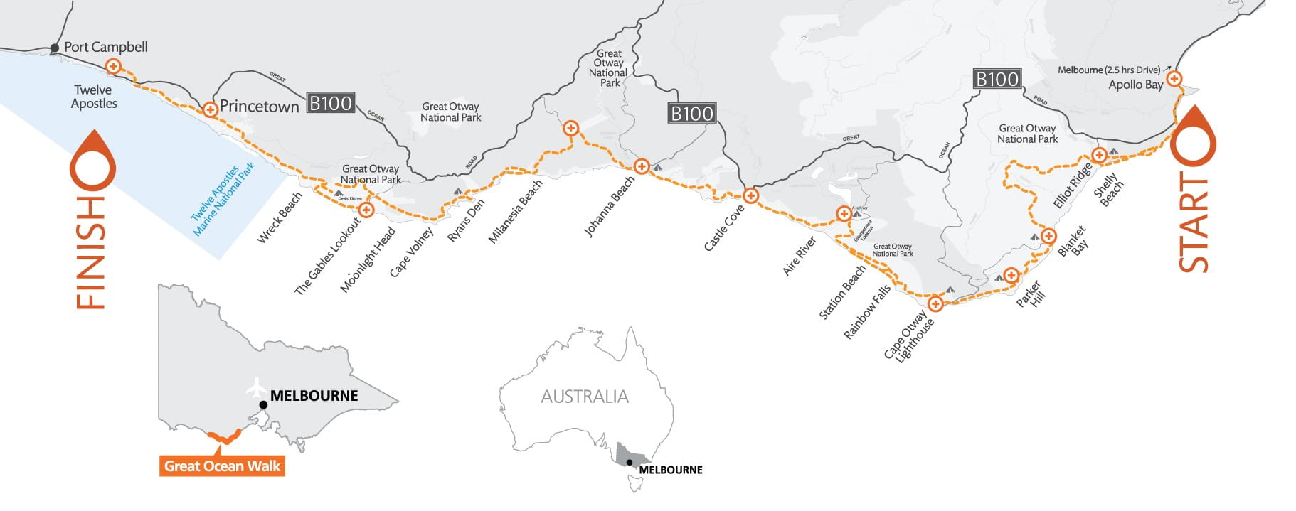
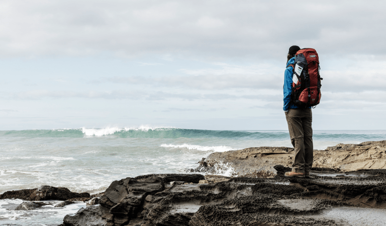
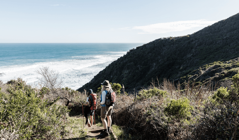
Return again and again and build your own Great Ocean Walk experiences. Several half-day walks explore the tall forests of the 'tamer side' or for the more experienced hiker, the remoter, steep and isolated coves of the 'wild side' in the sections closer to the Twelve Apostles.
Short Walks
Less than 3 hours in length, ranging in difficulty and all are accessible from established visitor car parks.
Lighthouse Cemetery and Lookout Walk – 800m, walk grade easy
The gravel path leads walkers from the carpark out through beard heath to a hilltop lookout. You will be rewarded with views across to the lighthouse, and the ocean. Visit the historic cemetery which bears witness to the realities of lives lost at sea and the harsh isolation of early light station life. Fee applies for Cape Otway Lightstation entry.
![]() Start: Cape Otway Lightstation carpark
Start: Cape Otway Lightstation carpark
![]() End: Cemetery
End: Cemetery
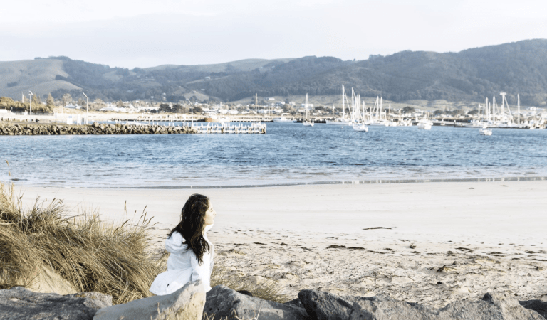
Marengo to Shelly Beach – 4.4kms, walk grade medium
A mixture of rocky foreshore, wind swept hilltop views and tall shady forest. The exposed, and aptly named, Bald Hill traverses on and off the beach through the sheltered forest to picturesque Shelly Beach and up to the picnic area. Take the coastal route at low tide and during calm seas.
![]() Start: Marengo caravan park
Start: Marengo caravan park
![]() End: Shelly Beach picnic area
End: Shelly Beach picnic area
Shelly Beach Walk – 900m loop, walk grade medium
This is one of the best short walks on the Great Ocean Walk. The track will take you through fern gullies, coastal scrub, to Shelly Beach.
![]() Start: Shelly Beach picnic area
Start: Shelly Beach picnic area
![]() End: Shelly Beach picnic area
End: Shelly Beach picnic area
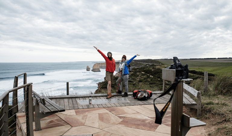
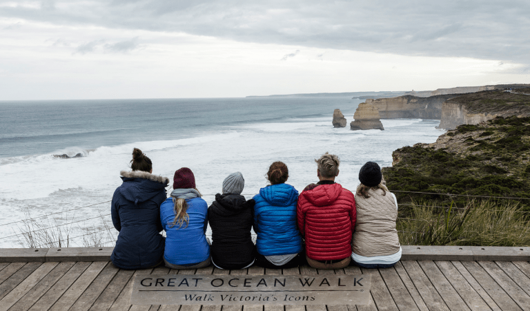
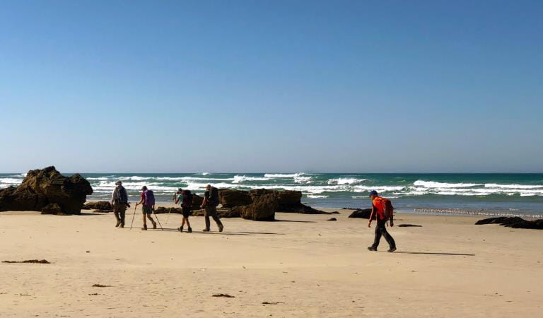
Princetown to the Twelve Apostles – 7.0kms, walk grade medium
The walk begins near the Gellibrand River Bridge. You will traverse cliff-tops and undulating heath-clad dunes as the distinctive rock stacks begin to reveal themselves. Continue past Gibson Steps Beach (which is not accessible at high tide) to end at the iconic Twelve Apostles kiosk and carpark facility.
![]() Start: Princetown Recreation Reserve
Start: Princetown Recreation Reserve
![]() End: Twelve Apostles kiosk and carpark facility
End: Twelve Apostles kiosk and carpark facility
The Gables Lookout – 400m, walk grade easy
This easy return walk travels through a Casuarina tree grove to a spectacular clifftop lookout. Enjoy views over the ocean and the reefs surrounding Moonlight Head. This is one of the highest sea cliffs on mainland Australia. Keep a close eye out for seabirds, or whales from June to September.
![]() Start: The Gable carpark
Start: The Gable carpark
![]() End: The Gable Lookout
End: The Gable Lookout
Wreck Beach – 350m, walk grade medium/hard
This difficult but rewarding walk descends over 350 steps to Wreck Beach. At low tide the walk takes you to the anchors of the Marie Gabrielle and the Fiji – haunting reminders of the treacherous nature of the sea. Make this walk at low tide only and beware of large sea swells.
![]() Start: Wreck Beach Carpark
Start: Wreck Beach Carpark
![]() End: Wreck Beach Carpark
End: Wreck Beach Carpark
Day Walks
Day walks are up to 6 hours in length. All walks start from the main visitor areas and the distance and terrain make these longer walks more challenging and requiring preparation for safety and enjoyment.
Aire River to Johanna Beach Day Visitor area –12.5 km, walk grade medium/hard
This is a long but satisfying walk through diverse terrain to beautiful Johanna Beach. Pass through heathland with spring wildflowers and experience awesome sea views. Watch above for Sea Eagles soaring overhead. Johanna River is an unbridged beach crossing, so carefully assess before wading across following heavy rains.
![]() Start: Aire River Visitor Area (information shelter)
Start: Aire River Visitor Area (information shelter)
![]() End: Johanna Beach Day Visitor Area.
End: Johanna Beach Day Visitor Area.
Cape Otway to Aire River – 10kms, walk grade medium
Explore the lightstation before you set out. The walk to Aire River carves its way through a wind-sculpted landscape of sand dunes, coastal scrubland and calcified cliffs. Along the way Station Beach (and Rainbow Falls) is side trip well worth taking. Rainbow Falls is spring-fed water trickling down through algae to the rock platform below. The Falls are a 3-kilometre return journey from where you first enter Station Beach at Decision Point 8. When you return from Rainbow Falls, exit Station Beach at either Decision Point 8 where you first entered the beach, or further towards Aire River at Decision Point 8B, which will take you back onto the main GOW route. Continue along to the Aire escarpment lookout, before descending down to the beautiful Aire River Campground.
![]() Start: Cape Otway Carpark
Start: Cape Otway Carpark
![]() End: Aire River Visitor Area
End: Aire River Visitor Area
More Great Ocean Walk Experiences
Licensed tour operators
Hike for 1–3 nights
Hike for 4–6 nights
Hike the whole 8 days
How to get there
Short and Day Walks
When you're there
Explore the region
Off-walk accommodation
Towns and Villages

Eat and Drink
Visitor Information Centres
Need to know
Short and Day Walks
Plan and Prepare
Walkers must move in an east-west direction. The walk was designed and built to be walked in an east-west direction. This will maximise views and generally provides the best gradient to reduce impacts from walkers and congestion of the walk and its facilities.
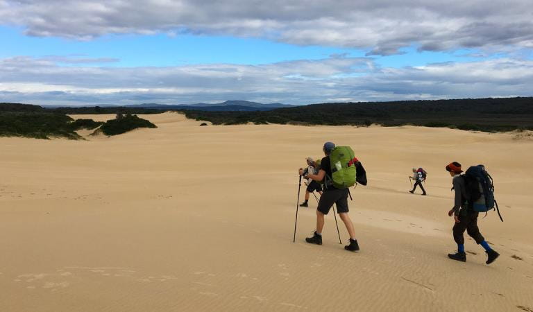
If you have not undertaken a long-distance walk before, or for a reasonable period of time, it is recommended you undertake some walk training. You will be walking all day, for up to 8 days. There are steep staircases and track sections that go up and down again. Sections of the track can be wet, muddy and slippery. Prepare well to enjoy yourself and get the most from your experience.
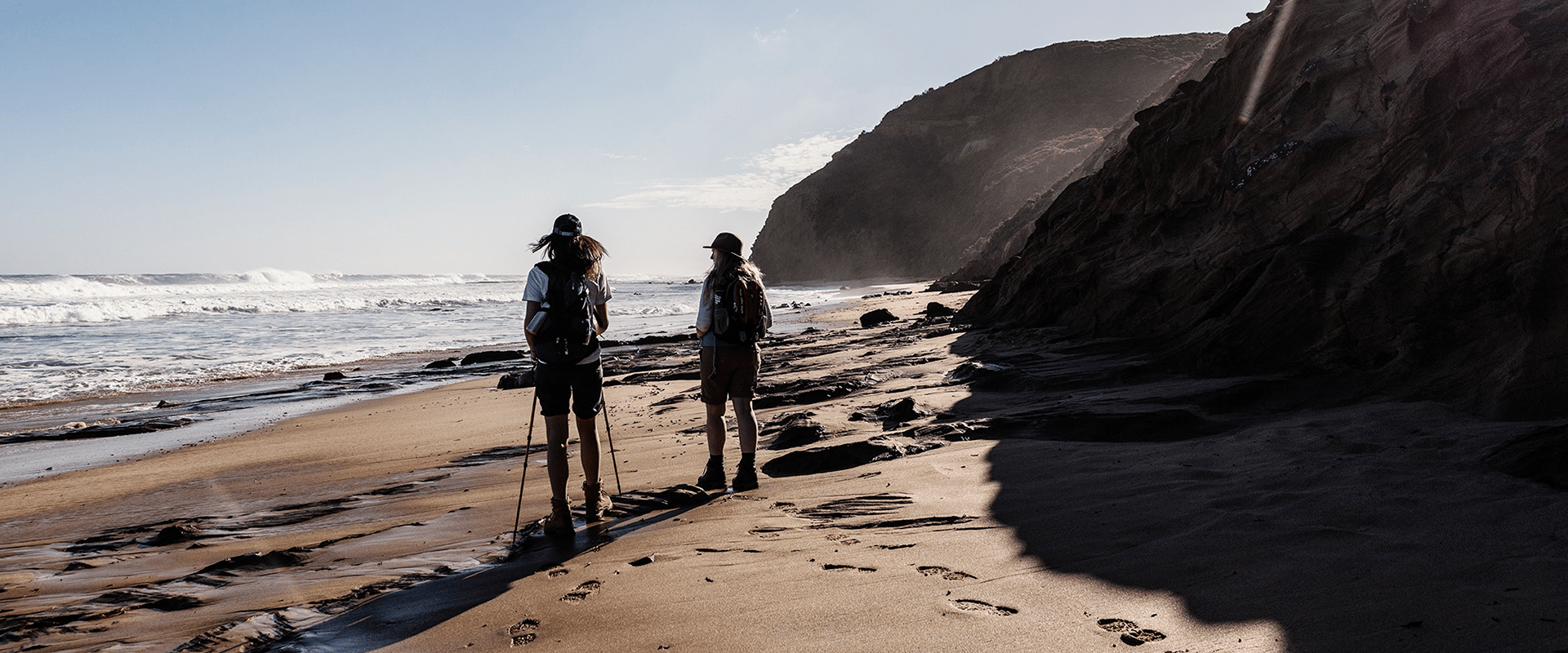
Beach Walking and High Tides
Planning ahead using tide times may save yourself a lot of inconvenience, disappointment and delay during your walk. Many beaches are exposed to high tides, large waves and hidden dangers like ocean currents, rips and reefs.
In some sections of the Great Ocean Walk, alternate beach walking sections are available. Beach access points are marked on the Great Ocean Walk Map and on the walk. Emergency markers state your ‘on and off’ access points and yellow flags mark track arrival and departure points from the beach.
The Great Ocean Walk in-land routes offer shelter from strong sun, bad weather, high tides and waves. It is vital that you consider tides, ocean swell and weather before taking an alternate route. Conditions may change quickly. You should only attempt to walk along the coastline during low tide and calm sea conditions.
The Great Ocean Walk route is clearly marked with signs and has inland options in all areas except Storm Point, West of Bald Hill, Johanna Beach and Milanesia Beach first section. Beach walking is required in the Milanesia (300m) and Johanna (2km) sections of the walk. These beaches and generally passable under normal tide and calm weather conditions. Only proceed with these sections when it is safe to do so.
Wreck Beach (at Moonlight Head) should only be walked at low tide. Walking under the cliff line can become dangerous or impassable at high tide or with large ocean swell. Ensure you are aware of Port Campbell tide times prior to attempting this section of the walk.
Refer to Port Campbell tide times (subtract 4 minutes from Portland tide times) for west of Moonlight Head to the Twelve Apostles, including Wreck Beach.
Refer to Apollo Bay tide times (subtract 28 minutes from Port Phillip Heads times) for east of Moonlight Head.
River crossings
No pedestrian bridge exists for Elliot, Parker Inlet, Johanna and Milanesia River crossings. Heavy rain, rough seas and high tides may make crossings at Elliot, Parker, Johanna and Milanesia Rivers challenging or impossible. Hikers may need to wade across rivers after high rainfall.
It is your responsibility to carefully assess depth and flow before you cross. Be prepared to wait until you consider it safe to cross.
Change of Conditions
Nature being nature, sometimes conditions can change at short notice. It’s a good idea to check this page ahead of your visit for any updates.
-
Aire River West Campground (Great Otway National Park GORCAPA, Aire River Heritage River)
Aire West Campground – Partial Seasonal Closure
Visitors are advised that sites 17–40 at Aire West Campground in Great Otway National Park are temporarily closed from 29 May to 25 September 2026 due to seasonal conditions.What to expect:Sites 17–40 are closed and unavailable for camping or vehicle access during this periodRemaining sites may still be accessible, subject to conditionsImportant information:The closure period may be extended if conditions remain too wet to safely support camping and vehicle accessVisitors are asked to follow any on-site signage and avoid closed areas to prevent damage to the campground and ensure safety.The Great Ocean Walk hike in camp site is not impacted.Entering into or camping within closed areas is subject to National Park regulationsWe appreciate your cooperation in helping protect the park during these conditions. -
Aire River East Campground (Aire River Heritage River, Great Otway National Park GORCAPA)
Aire East Campground – Seasonal Closure
Aire East Campground in Great Otway National Park will be closed from 29 May to 25 September 2026 as part of the annual seasonal winter closure.This closure is necessary to protect the campground and access tracks during periods of wet weather, when conditions are highly susceptible to damage from vehicle use and camping activity.What to expect:No visitor or vehicle access to the campground during the closure period.Campground and toilet facilities will be unavailable.Important information:The closure period may be extended if conditions remain too wet to safely support vehicle access and camping.Visitors are encouraged to plan ahead and consider alternative campgrounds.We appreciate your cooperation in helping protect the park environment during this time. -
Ironbark Basin Nature Trail (Great Otway National Park GORCAPA)
Surf Coast walk/ Ironbark Nature trail closure
The Ironbark Nature trail loop is undergoing storm damage repairs. It will be closed for the duration of the works. The section of the Surf Coast Walk between Ironbark carpark and Point Addis stairs will be closed also.
-
Notices Affecting Multiple Sites
Great Otway Natonal Park - flood damge impact
Severe thunderstorms and flash flooding on 16 January 2026 caused significant damage across parts of the eastern Great Otway National Park.Recovery works are ongoing.We are pleased to advise that some areas have now reopened, while others remain closed to ensure public safety during assessment and repair work.The following areas are now open to visitors:- Moggs Creek Picnic Area
- Distillery Creek Picnic Area
- Ocean Track
- Castle Rock
- Sheoak Falls to Swallow Cave Track
Parks Victoria has reopened sections of the Kalimna Falls Walking Trail, providing:
- Access from Sheoak Picnic Ground
- Walking access to Lower Kalimna Falls
- Return via the same route or continuing through to Garvey Track
✅ Open sections are marked in green on park signage/maps
❌ Closed sections remain in red and must not be enteredVisitors should remain on marked open tracks and follow all onsite signage.
⚠️ Important Visitor Advice- Always follow posted signage and staff directions
- Stay within reopened (green-marked) track sections
- Do not enter closed areas under any circumstances
- Conditions may change without notice
-
Great Otway National Park
Wye Road Closure
Due to recent storm and flood damage, Wye Road will remain closed until the end of winter to allow for road maintenance and repair works.
Similar Trails
Great South West Walk
Grampians Peaks Trail