
Grampians National Park is part of the Gariwerd Aboriginal cultural landscape. Parks Victoria respects the deep and continuing connection that Traditional Owners have to these lands and waters, and we recognise their ongoing role in caring for Country.
![]()
![]()
![]()
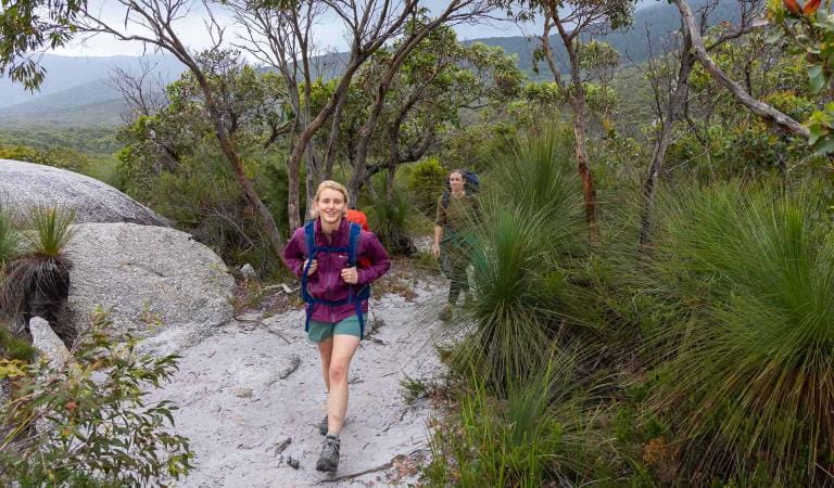
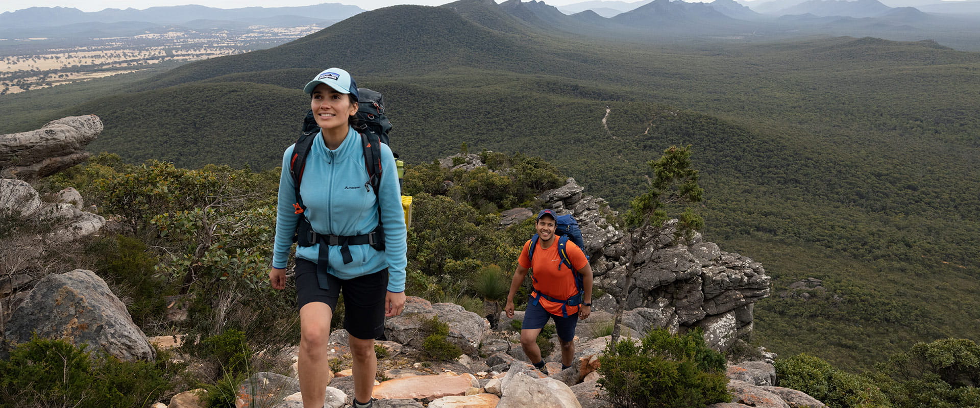
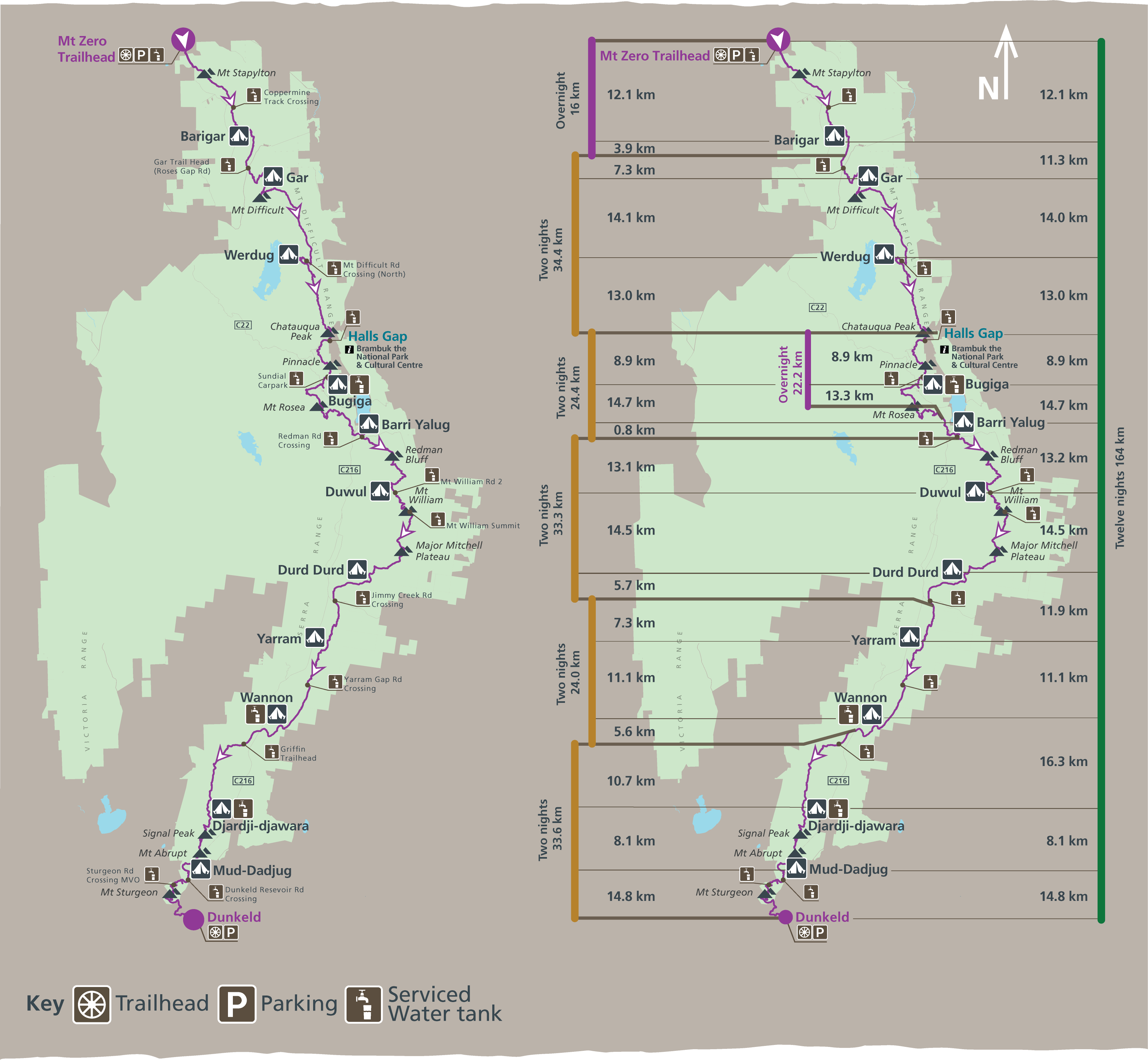
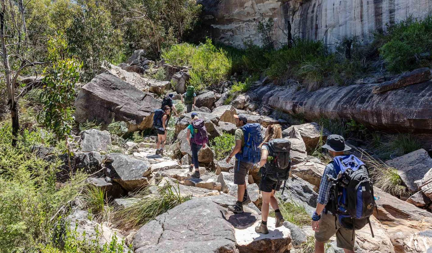
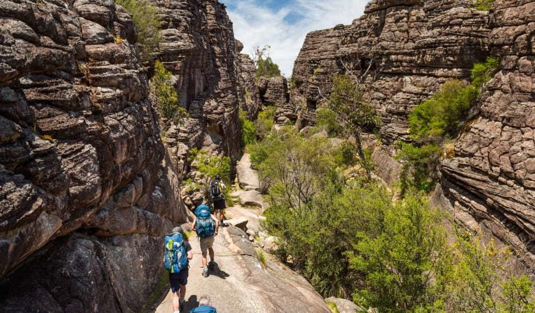
The spectacular Grampians Peaks Trail (164km) is a challenging 13-day/12-night hiking experience through a variety of terrain in the Grampians (Gariwerd) National Park. Starting at Mt Zero in the north and heading south, the trail passes over the summit of Gar (Mt Difficult), continues through Halls Gap with hiking highlights including Redman Bluff, Mount William, Major Mitchell Plateau, Signal Peak, Mt Abrupt, Mt Sturgeon (and more) before reaching Dunkeld in the south.
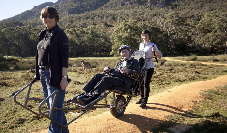
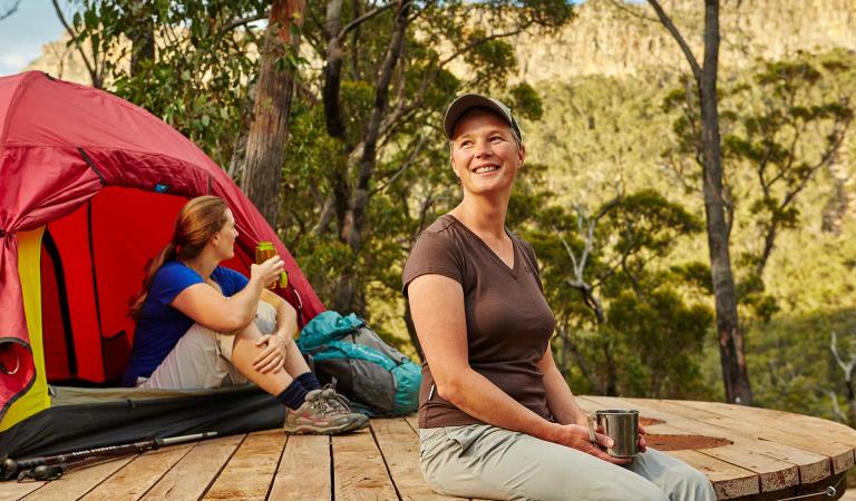
Stay at unique hike-in campgrounds along the trail, climb dramatic mountain peaks with panoramic views and hike along rugged rocky ridgelines. Experience a rich diversity of plants and animals and the ancient Aboriginal culture of Gariwerd. The trail caters for a variety of hiking styles, from self-guided walkers and groups to school groups and fully-facilitated hikes with a Licensed Tour Operator.
New changes to booking system
We have made changes to the Grampians Peaks Trail booking system making it easier to book and with more flexibility in how you plan your hike. Find out more.
 Plan and prepare
Whether going for a day walk, multi-day hike or the full 13-day experience, start planning your Grampians Peaks Trail adventure and download the Grampians Peaks Trail Plan and Prepare Guide.
 Book
Book
Book on-trail hike-in campgrounds before you start a multi-day hike (camping fees apply). See Visit Grampians for off-trail accommodation, tours and transport options.
 Get packing
Pack your gear and equipment, food and water. Include maps and safety devices. See the handy packing list in the Grampians Peaks Trail Plan and Prepare Guide.
 Set off and stay safe
Set off on your Grampians Peaks Trail adventure only when know how to walk it safely. Read the safety and emergency information, and check for any last minute changes of conditions. You can also call into Brambuk the National Park and Cultural Centre in Halls Gap and speak to knowledgeable staff for the latest park information.
 Care for Country
Minimise your environmental impact when completing the Grampians Peaks Trail. Take out what you take in – leave no rubbish behind. Stay on the trail, leave pets, drones and loud music at home. Campfires are not permitted.
 Share
Share
Share photos and videos of your Grampians Peaks Trail adventure on social media and inspire others to do it. #grampianspeakstrail
Choose your journey
Grampians Peaks Trail
Choose an option below and find out more.
Book Grampians Peaks Trail your way
We've opened up flexibility in how you choose to hike GPT. Plan your itinerary, then use the interactive map to book your hike.
Choose your own adventure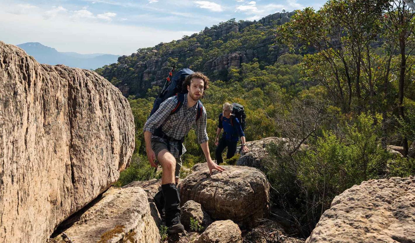
Full Grampians Peaks Trail (north to south)
If you’re bold and committed to completing this 13-day/12-night hike, you will have an unforgettable adventure and be rewarded with some of the best hiking trails and panoramic views in Australia.
Explore the full trail experience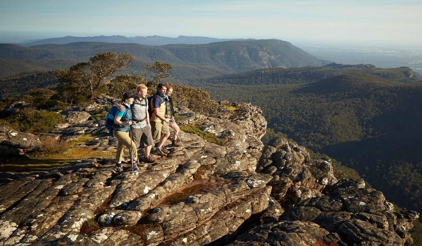
Northern Peaks Experience (Huts)
The Grampians Peaks Trail provides hikers with the option of staying in eco-friendly hiker huts on the Northern Peaks’ (Gar and Werdug) two-night itinerary.
Experience the Northern Peaks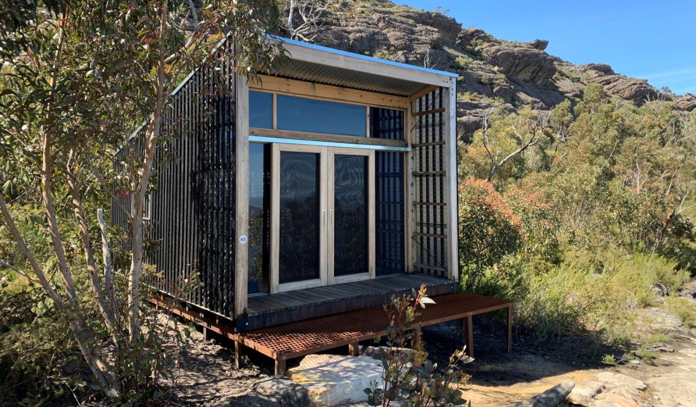
Multi-day hikes (3 days or more)
For people who enjoy an outdoor adventure but don’t have time to do the full 13-day Grampians Peaks Trail, breaking it up into smaller 3-day hikes is a great way to challenge yourself, build-up long distance hiking skills and experience the spectacular living cultural landscape of Gariwerd. Return again at your leisure to complete more sections of the trail. You can also add individual overnight and 3-day hike itineraries together to create your preferred hiking adventure.
Explore multi-day hikes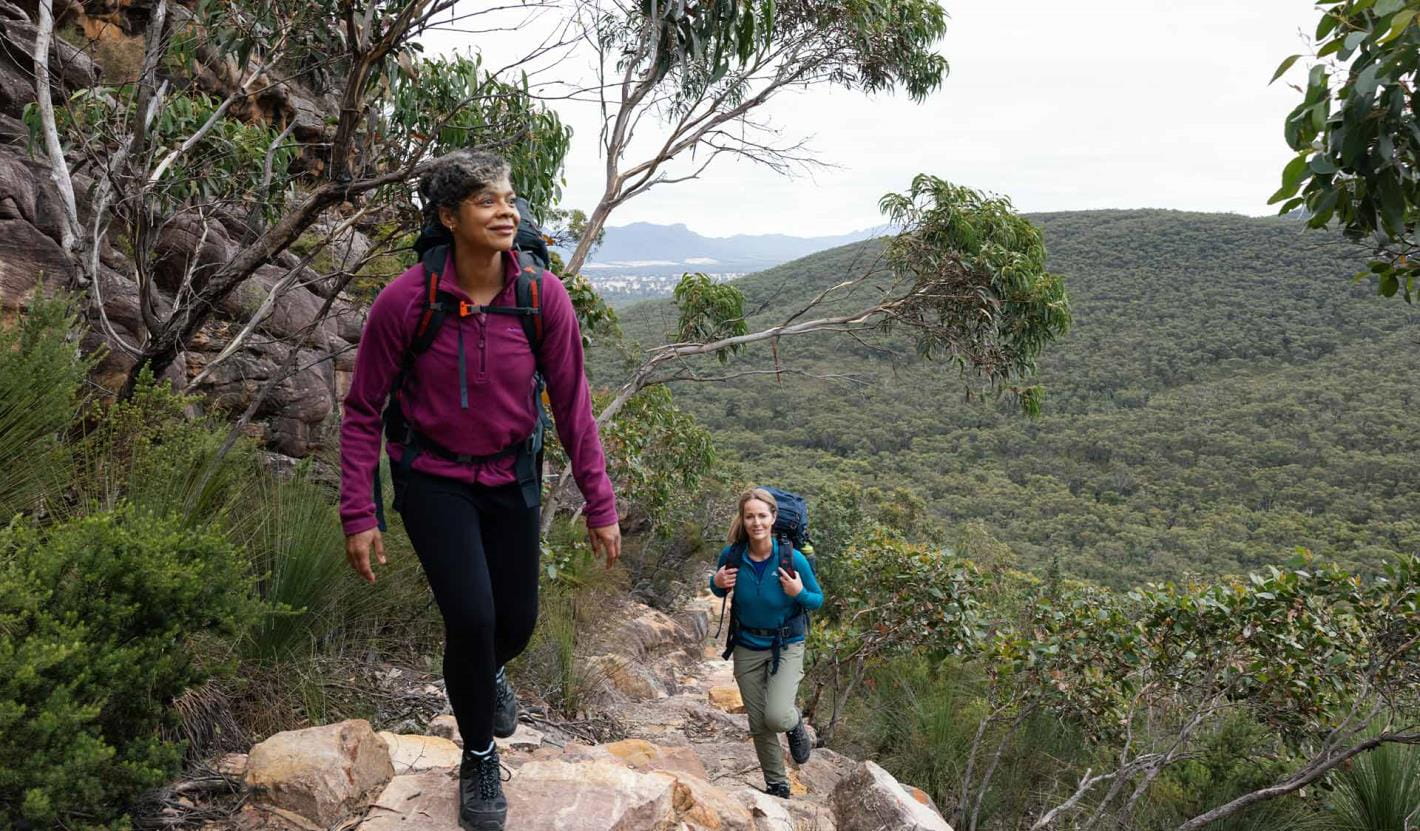
Overnight hikes
Choose from three different 2-day hikes available and explore the trail that little bit further.
Explore overnight hikes
Day walks
Day walks are a great way to try smaller sections of the trail. Choose from some of our favourites in northern, central and southern Grampians.
Explore day walks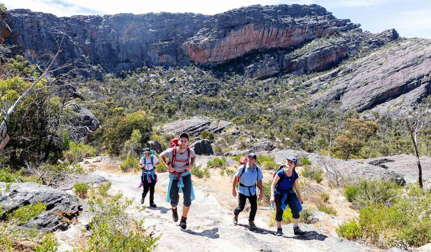
School and independent groups
Schools including clubs and independent groups, wishing to undertake the Grampians Peaks Trail have the option of walking and camping on trail or camping off trail in designated group camps or private accommodation nearby.
To walk and camp on trail, group sizes are up to 16 people, depending on site availability.
Experience with a Licensed Tour Operator
One of the best ways to experience the Grampians Peaks Trail is with a Licensed Tour Operator. Whether you're looking for a fully guided experiences or just support services, here you'll find a Licensed Tour Operator that assist you.
Go with a Licensed Tour Operator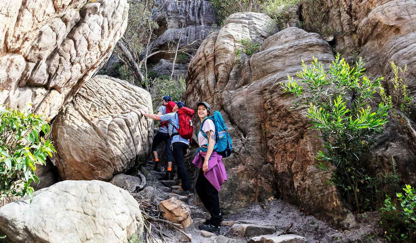
Enhance your experience
Grampians Peaks Trail
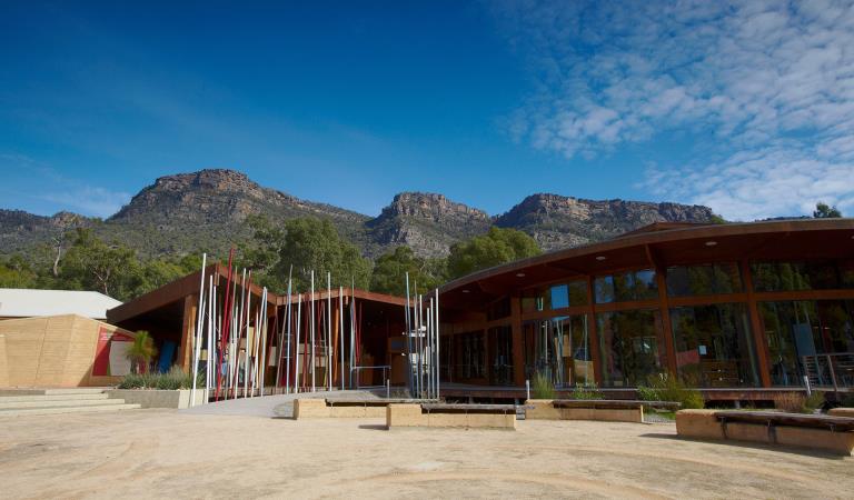
Brambuk The National Park and Cultural Centre
Explore the region
Prepare for your adventure
Grampians Peaks Trail
Water safety
Plan and prepare
Change of park conditions
During the summer of 2024-2025, widespread bushfires impacted over 135,000 hectares in the central, west and south-eastern sections of Grampians (Gariwerd) National Park. For up-to-date information on what’s open and closed along the Grampians Peaks Trail, view change of conditions on the Grampians (Gariwerd) National Park page. For further information on the phased fire recovery program in Grampians (Gariwerd) National Park please visit the Grampians (Gariwerd) National Park Fire Recovery page.
More information about Grampians Peaks Trail
GPT topographic maps
Visit Brambuk - The National Park and Cultural Centre in Halls Gap for topographic maps and speak to knowledgeable staff for the latest park information.
You can also order Grampians Peaks Trail topographic maps over the phone from Brambuk, call 8427 2058 (open 9am-5pm daily; except Christmas Day).
7 Things You Need To Know About Hiking the Grampians Peaks Trail
Laura Waters, long distance hiker and author, was one of the first hikers on the trail, setting out on the first day of the GPT opening. Read the Ultra Hiker article.
Hike the Grampians Peaks Trail with Caro Ryan
These videos, in partnership with Caro Ryan from LotsaFreshAir, show you the terrain, what to expect and include helpful tips on how to prepare for this challenging Grade 4 hike. Join Caro on her experience below.
Grampians Peaks Trail - North Section
Grampians Peaks Trail - Central Section
Grampians Peaks Trail - South Section
How to prepare your fitness and body for the Grampians Peaks Trail
Grampians Peaks Trail Logistics and Planning
Grampians Peaks Trail - Everything you Need to Pack Explained in 5 Categories
How to get there
The Grampians Peaks Trail runs from the northern point of the Grampians National Park (near Dadswells Bridge) to the southern point of the park (at Dunkeld). It is located in Western Victoria, a three-hour (260km) drive from Melbourne and a five-hour (460km) drive from Adelaide. The central Grampians is easily accessed from the villages of Halls Gap and Wartook and is a scenic day trip from the regional towns of Hamilton, Horsham, Stawell and Ararat. It is also a key destination on the internationally renowned Great Southern Touring Route.
Change of Conditions
Nature being nature, sometimes conditions can change at short notice. It’s a good idea to check this page ahead of your visit for any updates.
-
The Fortress Walk (Victoria Range Remote and Natural Area, Grampians (Gariwerd) National Park)
The Fortress Walk and Hike-in Campground – Temporary closure
The Fortress Walk and The Fortress Hike-in Camp remain closed to visitors due to track damage from the 2024/25 summer bushfires.For more information on alternate walks in the western section of the Grampians (Gariwerd) National Park visit Brambuk the National Park and Cultural Centre in Halls Gap or call 03 8427 2058. -
The Chimney Pots Walk (Victoria Range Remote and Natural Area, Grampians (Gariwerd) National Park)
The Chimney Pots Walk – Temporary closure
The Chimney Pots Walk remains closed to visitors due to track damage from the 2024/25 summer bushfires.For more information on alternate walks in the western section of the Grampians (Gariwerd) National Park visit Brambuk the National Park and Cultural Centre in Halls Gap or call 03 8427 2058. -
Red Gum Walk (Grampians (Gariwerd) National Park)
Red Gum Walk – Temporary closure
The Red Gum Walk remains closed to visitors due to track damage from the 2024/25 summer bushfires.For more information on alternate walks in the western section of the Grampians (Gariwerd) National Park visit Brambuk the National Park and Cultural Centre in Halls Gap or call 03 8427 2058. -
Strachans Campground (Grampians (Gariwerd) National Park)
Strachans Campground –Temporary Closure – 13 April – 30 July 2026
Strachans Campground will be closed to visitors between 13 April and 30 July 2026 while major upgrade works are completed.For further information contact Brambuk the National Park and Cultural Centre in Halls Gap (Ph 8427 2058). -
Mackenzie Falls Day Visitor Area (Grampians (Gariwerd) National Park)
Mackenzie Falls (Migunang wirab) - Upcoming closure for major construction works – 9 February 2026 to the end of 2026
This update is to provide information for the planned construction work at Mackenzie Falls in the Grampians (Gariwerd) National Park, and closures while the works happen.The works at Mackenzie Falls precinct includes the construction of a new viewing platform at the base of the falls, upgrades to the carpark and the Bluff Lookout Walk and other important safety improvements to stabilise rock and improve walking tracks.
The Mackenzie Falls carpark and all walking tracks in the precinct including Broken Falls Walk, Mackenzie Falls Walk to the base (from the carpark), the Bluff Lookout Walk, and parts of Mackenzie Falls River Walk will close when construction starts on Monday, 9 February, 2026, and we anticipate that construction work will finish by the end of 2026.The carpark will be a construction site throughout the works period with large machinery operating and materials being stored on site. There will be no access for all vehicles or visitors at Mackenzie Falls Precinct during construction.Zumsteins Picnic AreaWhen construction works start at Mackenzie Falls precinct, parking at the popular Zumstein picnic area will be limited, especially for large vehicles (buses and caravans) during weekends and holiday periods.Zumsteins to Fish Falls – This popular walk to the beautiful Fish Falls is a 1.5 to 2 hour return walk (Grade 3) – walkers should have a reasonable fitness level, carry water and wear sturdy walking shoes as the track can be rocky with uneven surfaces and some steep sections.Mackenzie River WalkFrom May 2026 until works are complete, the base of Mackenzie Falls will not be accessible via the Mackenzie River Walk from Zumsteins Picnic Area.
For further information on the Mackenzie Falls (Migunang wirab) project visit https://www.parks.vic.gov.au/projects/western-victoria/mackenzie-falls-revitalisation
Popular day visitor sites such as Reeds Lookout, the Balconies, Boroka Lookout, Silverband Falls and various walks with large bus carparking will still be available. For further information on the Mackenzie Falls River Walk contact Brambuk the National Park and Cultural Centre in Halls Gap (Ph 8427 2058).Please keep up to date with closures through the Change of Conditions page for Grampians (Gariwerd) National Park. -
Grampians (Gariwerd) National Park
Grampians (Gariwerd) National Park - Roads Update 17.07.2026
The Grampians (Gariwerd) National Park has roads temporarily closed due to bushfire and weather impacts.Please observe road closures, hazard signage and always drive to conditions.Seasonal Road Closures are now in place from the 9 June 2026 to 29 October 2026.Please refer to the attached up-to-date road report below.Attachments: Grampians (Gariwerd) National Park - Road Report 17.07.2026 (230KB)
Temporary closure of a Glenelg River Road section – 25 May to 24 July 2026
The section of Glenelg River Road from the Stony Creek Road intersection to the Boreang Campground turn off will be closed from Monday 25 May 2026 to Friday 24 July 2026 for roadworks.The southern end of the closure can be accessed via Rose Creek Road. Paddy Castle Walk and Boreang Campground remain open, as does Glenelg River Road, south of Lodge Road.For further information please contact Brambuk the National Park and Cultural Centre Phone 8427 2058.Aerial pest animal control program in the Grampians (Gariwerd) National Park – 27 to 31 July 2026
Parks Victoria is conducting a conservation program to improve the health of the Grampians (Gariwerd) National Park, following the devastating 2024-25 summer bushfires, which impacted approximately 80% of the park.Action is being taken to reduce predators (foxes and feral cats) and introduced herbivores (deer and feral goats), threatening the survival and recovery of vulnerable native plants and animals.Weather permitting, an aerial control operation will be conducted from Monday 27 July to Friday 31 July 2026 to support ongoing conservation programs.To ensure visitor safety, warning signs will be placed at temporary closures and road access points to restrict access to the operational areas. Parks Victoria rangers will also be on the ground at key closures. Visitors are encouraged to follow instructions from staff and information on temporary signage.No additional closures of visitor sites or campgrounds are being implemented. This includes the Grampians Peaks Trail (GPT) and GPT Hike-in campgrounds. The GPT will be buffered out of the operations area.Please see attached Fact Sheet for further details of the Aerial pest animal control operation.For further information please contact Brambuk the National Park and Cultural Centre on 03 8427 2058.Attachments: Gariwerd Aerial Pest Animal Control Program July 2026 Fact Sheet (519KB)
-
Brambuk the National Park and Cultural Centre (Brambuk - The National Park and Cultural Centre Park, Grampians (Gariwerd) National Park)
Brambuk the National Park and Cultural Centre – Building Upgrades in 2026
The Cultural Centre is closed for refurbishment.Parks Victoria is working with a strategic partnership committee of Gariwerd Traditional Owners from Barengi Gadjin Land Council, Eastern Maar Aboriginal Corporation, and Gunditj Mirring Traditional Owners Aboriginal Corporation to ‘reimagine’ the future of Brambuk the National Park and Cultural Centre.Building upgrades are essential to ensure the centre meets current services requirements, accessibility, and compliance to current building regulation. New visitor experiences and activation opportunities including Aboriginal arts, community events and cultural exhibitions are being explored as Brambuk moves towards operation by a Gariwerd Traditional Owner entity.The National Park Information Centre and gift shop remain open.For up-to-date national park information, brochures, maps, permits and access advice contact information staff at Brambuk the National Park and Cultural Centre info@parks.vic.gov.au or phone 8427 2058For Junior Ranger School holiday programs visit https://www.parks.vic.gov.au/things-to-do/junior-rangersFor a list of Grampians (Gariwerd) National Park Licensed Tour Operators Visit https://www.parks.vic.gov.au/ltoFurther details on the Brambuk Reimagining project can be found on the Parks Victoria website https://www.parks.vic.gov.au/projects/western-victoria/brambuk-cultural-centre-upgrade
Similar experiences at other parks
Great Ocean Walk
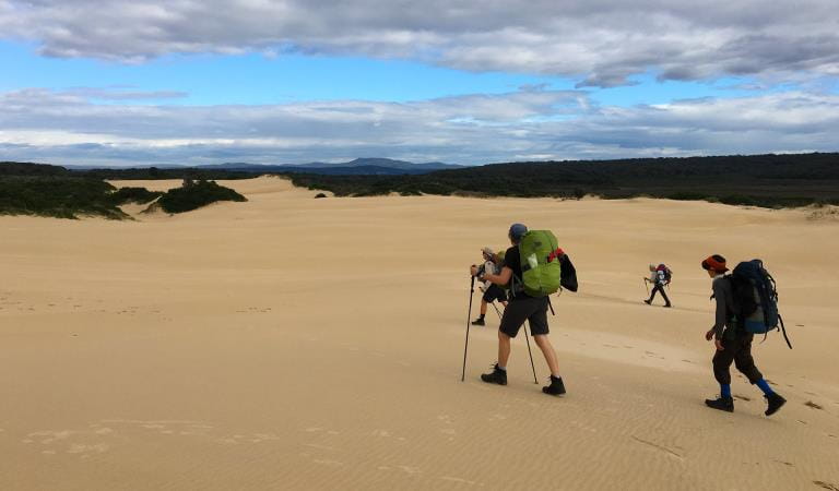
Great South West Walk
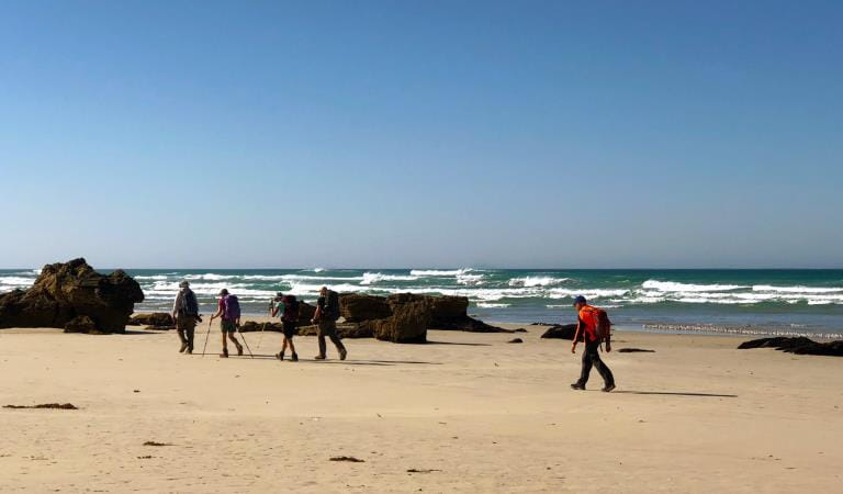
Wilderness Coast Walk
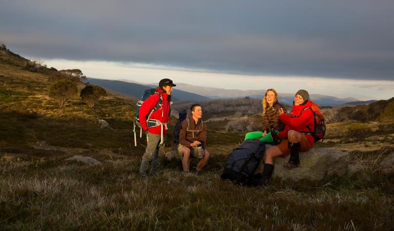
Falls to Hotham Alpine Crossing
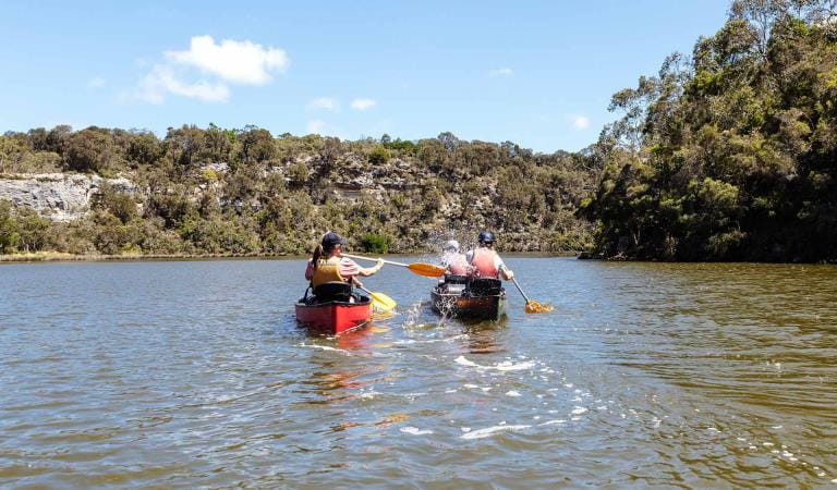
Glenelg River Canoe Trail
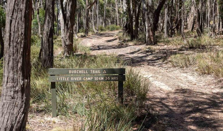
Burchell Trail
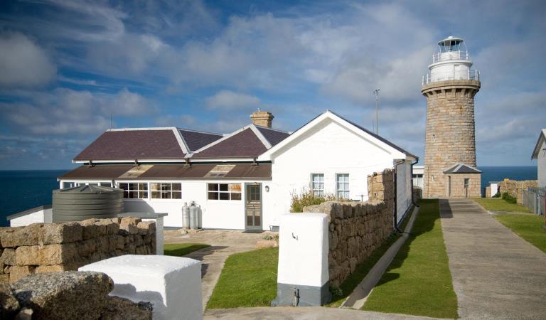
Wilsons Promontory Lightstation