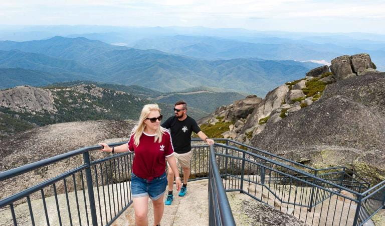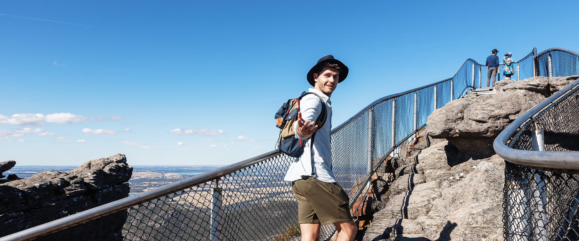
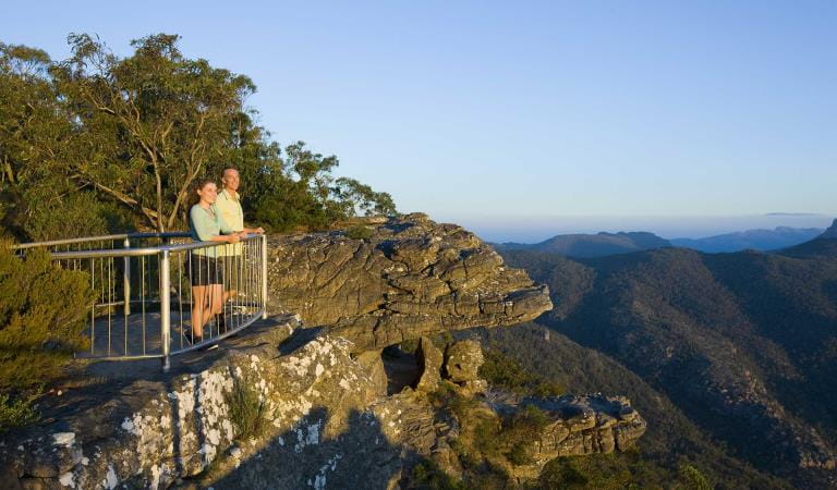
From the street, The Pinnacle appears unnervingly high and potentially difficult to walk. The good news is that it is not, and the views from the lookout make every bit of effort worthwhile. It is one of the very best vantage points in the Grampians National Park for terrific scenic views over a vast expanse of western Victoria.
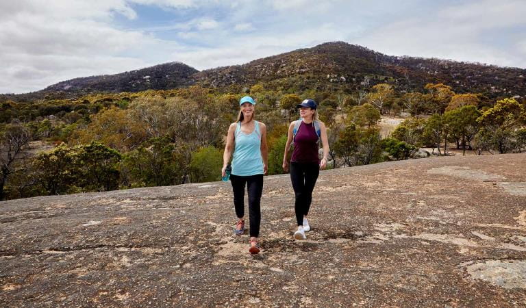
There are a number of walking options to reach The Pinnacle, varying in distance and difficulty. The easiest route to The Pinnacle departs from the Sundial carpark within the national park and ascends to The Pinnacle via Devils Gap. This is the best route to use if young children or unconfident walkers are part of your walking group. The 4.2km walk will take one and a half to two hours for the return trip. It does include some water crossings and rock-hopping, so good sturdy shoes are essential.
A more challenging walk departs from the aptly named Wonderland carpark and ascends via the impressive Grand Canyon. It does not resemble the American canyon of the same name but is equally impressive with its unique Australian rock formations, albeit on a smaller scale! The walk continues through the Silent Street before rising up to The Pinnacle.
For the really adventurous, you can walk to The Pinnacle from the base of the mountains, starting at the Halls Gap caravan park. This extended walk will take around five hours return so is suitable for fit and experienced walkers.
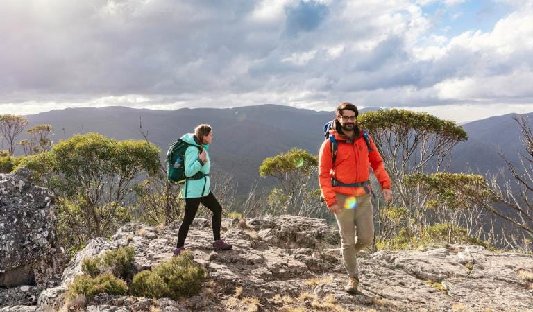
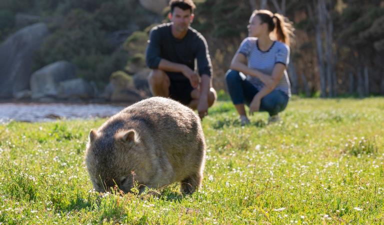
All these walks offer a variety of incredible rock formations to see and negotiate, as well as lush vegetation that has recovered from bushfires with fresh spurts of new growth. In springtime, wildflowers burst into life with their brilliant bright colours. With an abundance of wildlife living in the park, your walk may also include glimpses of koalas, kangaroos, snakes, skinks and maybe even an echidna or two.
Whichever way you get there, the view from The Pinnacle lookout will astound you. While you get your breath back after your ascent, you will be able to see Halls Gap far below you, as well as Lake Bellfield. Plus you will get a close-up look at the irregular and fascinating rock formations for which the Grampians are so well-known.
The Pinnacle walks
Hiking and bushwalking
Bird watching
Wildlife viewing
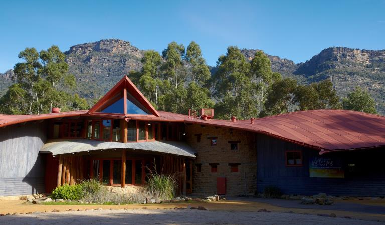
Brambuk The National Park and Culture Centre
How to get there
The Pinnacle walks
When you're there
Need to know
The Pinnacle walks
Accessibility
Visiting a park can be more of a challenge for people with disabilities, however in Victoria there are a wide range of facilities to help people of all abilities enjoy our wonderful parks around the state.
Assistance dogs are welcome in Parks Victoria parks and reserves. Entry requirements apply for parks and reserves that are usually dog prohibited, such as national parks.
Change of Conditions
Nature being nature, sometimes conditions can change at short notice. It’s a good idea to check this page ahead of your visit for any updates.
-
Grampians (Gariwerd) National Park
Partial closure of Coppermine Track
Coppermine Track between Coppermine 4WD campground and Mt Zero Rd is currently closed to vehicles as the track has become impassable.Grampians (Gariwerd) National Park - Roads Update 27.06.2025
The Grampians (Gariwerd) National Park has many roads temporarily closed due to the recent bushfires. Please be aware the movement of visitors in parts of the National Park is restricted.Key roads open include Grampians Tourist Rd (most side roads remain closed), Mt Victory Rd, Sundial Rd, Silverband Rd, Roses Gap Rd, Mt Zero Rd and Victoria Valley Rd.Seasonal road closures are now in place from June 12 – October 30, 2025.Please refer to the attached up-to-date road report below.Attachments: Grampians (Gariwerd) National Park - Road Report - 27.06.2025 (222KB)
Temporary Closure – Sundial Carpark
Sundial Carpark will be closed for pavement repairs on Thursday the 3rd of July 2025 and will reopen on Friday the 4th of July. Access to Lakeview Loop, Wonderland Forest Loop Track and other nearby open walks is available from Wonderland Carpark.Grampians (Gariwerd) National Park – What’s Open What’s Closed Update – 4 July 2025
During the summer of 2024/2025 the central, southern and western areas of the Grampians (Gariwerd) National Park were impacted by multiple bushfires. Since then, a staged re-opening has commenced and many popular visitor areas have re-opened in the Northern, Wonderland and southern areas of the park. However, in the Mount William, Victoria Range, Victoria Valley and Wallaby Rocks areas; many visitor sites and roads remain closed.Visitor Sites Reopening 4 July 2025Central Grampians, Wonderland Range & Halls Gap area:· Mount Rosea walking track· Borough Huts Campground· Stony Creek Group Campground· Stony Creek Road (providing access to Stony Creek Group Campground)· Bugiga Hike-in Campground· Tunnel Track· Terraces Fireline (walking only – an alternate walking link from Borough Huts Campground to Halls Gap)Grampians Peaks TrailThe popular section from Sundial Carpark to Borough Huts campground will reopen. This includes Bugiga Hike-in Campground and Stony Creek Group Campground, providing a two day and one night walking experience from Halls Gap or a two-night, three-day experience by hiking an alternate route along Terraces Fireline returning to Halls Gap.The Griffin Fireline reopens with vehicle access to the Griffin Trailhead in the (Serra Range) southern section. The upgraded track is now accessible to all vehicles.Key visitor sites remaining closedCentral Grampians, Wonderland Range & Halls Gap area:· Sundial Peak walking track· Designated climbing areas 83 - 91Roads in fire impacted areasIt is expected that most of the roads within the National Park will reopen to the public by mid to late July. There will be longer term closures required for some roads, where significant damage has occurred and further essential works are required.Stay safe when visiting the parkDo not enter closed fire affected areas, they are fragile and unstable with significant hazards such as falling trees, unstable tracks and loss of signage.For more detail on “What’s Open What’s Closed”Please refer to the attached “What’s Open What’s Closed” July 4 Park Update. It provides a park wide compilation of all three staged fire recovery reopening’s in 2025.For further information, visit Brambuk the National Park and Cultural Centre in Halls Gap, call Parks Victoria on 131963 or go to parks.vic.gov.auAttachments: GNP Park Update 4 July 2025 - What's Open What's Closed (846KB)
Grampians (Gariwerd) National Park – Fire Recovery Update
The impact of the 2024/2025 summer fires in the Grampians (Gariwerd) National Park was widespread. Parks Victoria is now progressing with large scale fire recovery works across the park, including dedicated programs to address biodiversity impacts.For more detailed information, please see the attached Biodiversity Newsletter.Attachments: GNP Biodiversity Newsletter May 2025 (872KB)
-
Brambuk the National Park and Cultural Centre (Grampians (Gariwerd) National Park, Brambuk - The National Park and Cultural Centre Park)
Brambuk the National Park and Cultural Centre – Closures during 2025
Brambuk the National Park and Cultural Centre – Closures during 2025· Cultural tours, activities and venue hire currently unavailable.· Park information centre and gift shop remain open.Parks Victoria is working with a strategic partnership committee of Gariwerd Traditional Owners from Barengi Gadjin Land Council, Eastern Maar Aboriginal Corporation, and Gunditj Mirring Traditional Owners Aboriginal Corporation to ‘reimagine’ the future of Brambuk the National Park and Cultural Centre.The reimagining project aims to renew Traditional Owner management arrangements of the Brambuk precinct and includes careful consideration of the tourism and visitor experiences, commercial opportunities, cultural education and training programs that may be available in the future. As part of this project, there are also building upgrades and refurbishments that require the Cultural Centre to be closed during 2024-25. However, the park information centre, gift shop and self-guided walks remain available.For Junior Ranger School holiday programs visit https://www.parks.vic.gov.au/things-to-do/junior-rangersFor a list of Grampians (Gariwerd) National Park Licensed Tour Operators Visit https://www.parks.vic.gov.au/ltoFor up-to-date national park information, brochures, maps, permits and access advice contact information staff at Brambuk the National Park and Cultural Centre info@parks.vic.gov.au or phone 8427 2058Further details on the Brambuk Reimagining project can be found on the Parks Victoria website https://www.parks.vic.gov.au/projects/western-victoria/brambuk-cultural-centre-upgrade
Similar experiences
Reeds Lookout
Flinders Peak Lookout