Grade 4

Grampians National Park is part of the Gariwerd Aboriginal cultural landscape. Parks Victoria respects the deep and continuing connection that Traditional Owners have to these lands and waters, and we recognise their ongoing role in caring for Country.
![]()
![]()
![]()
Gar and Werdug 3-day/2-night hiking itinerary
This section of the Grampians Peaks Trail has not been affected by recent bushfires in the national park.
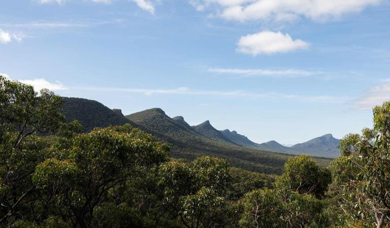
Along this hiking itinerary in the northern section of the Grampians Peaks Trail, you'll witness seasonal waterfalls, climb mountain summits and enjoy clifftop camping.
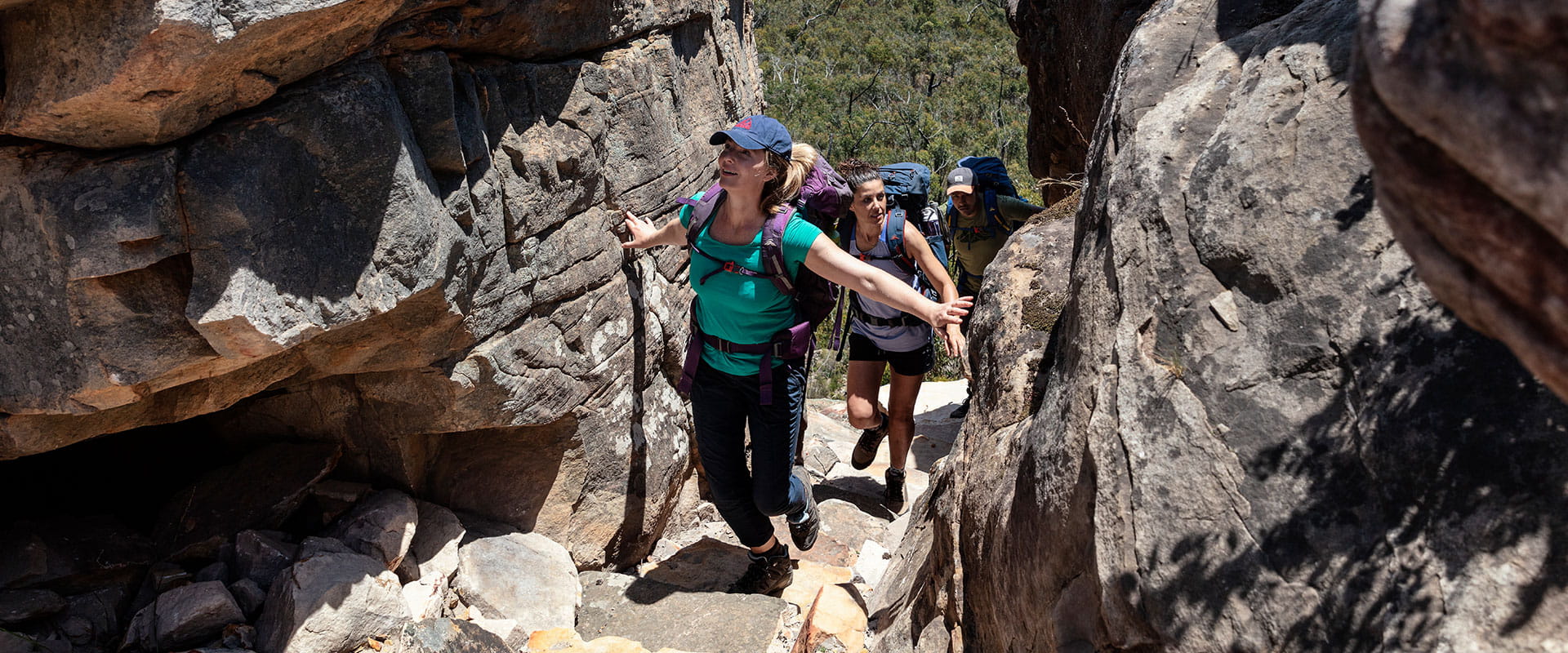
The track is an overall Grade 4 walk with steep and uneven terrain, suitable for fit and experienced hikers.
Gar (meaning ‘big mountain’) is the highest on the western side of the range, an optional side trip on day two will reward you with spectacular 360-degree views. On day three you’ll reach Lake Wartook Lookout (829m) which is one of the highest points on the eastern side of the Mount Difficult Range with sweeping 360-degree views of Gariwerd.
This section of the Grampians Peaks Trail is particularly spectacular in winter, spring, and after rain, when clifftop rockpools and seasonal waterfalls are at their best.
Distance: 34km
Duration: 3 days
Elevation: 1526m
Grade: 4
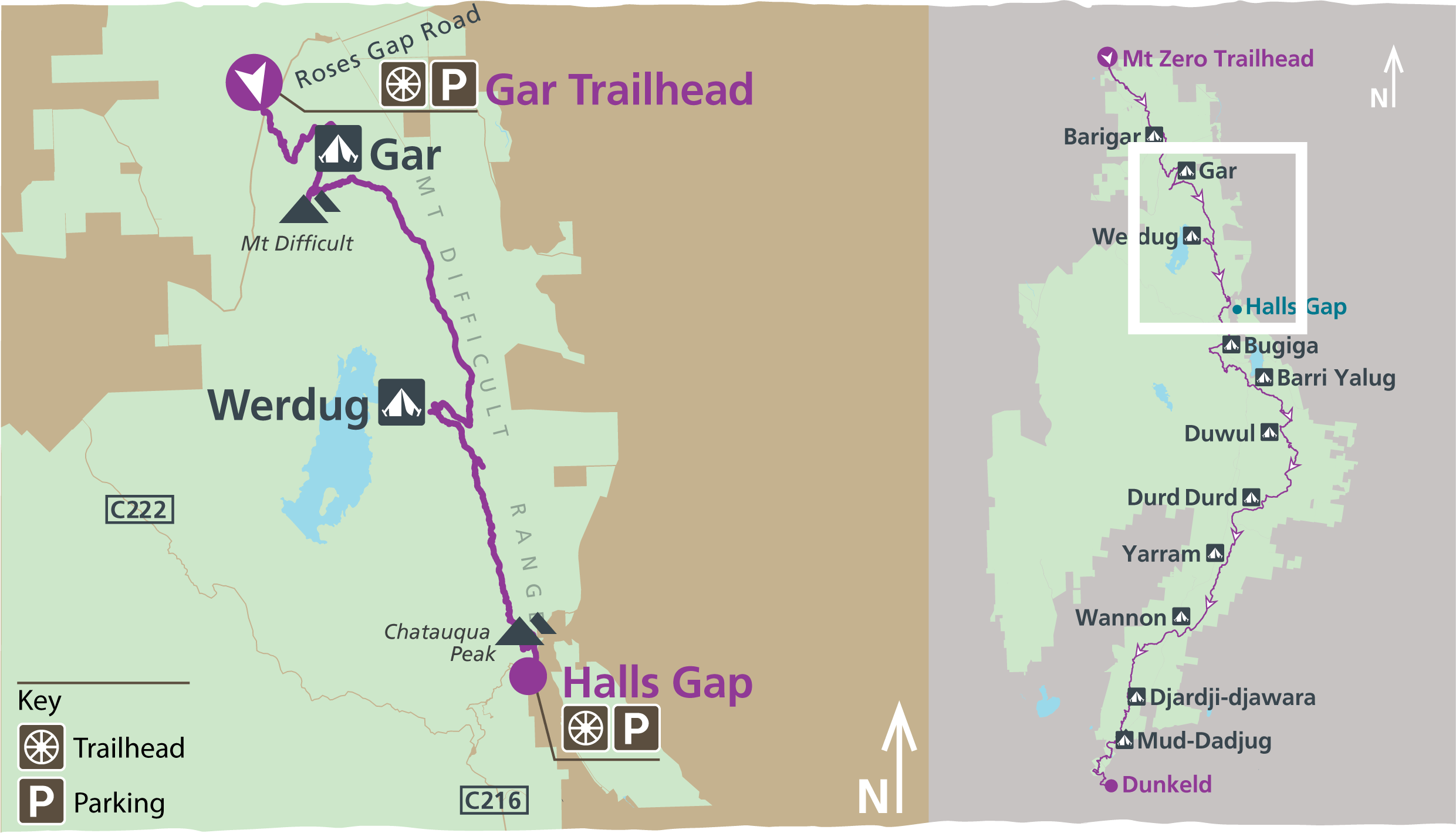
Northern Grampians Peaks Trail map – Gar and Werdug
Hike options
- Self-guided: the trail is free to self-guided hikers, but camping fees apply to stay overnight. Book campgrounds.
- Fully-facilitated: book a Northern Peaks Experience through a Licensed Tour Operator. Find out more.
Getting there
This section of the trail begins from Gar Trailhead on Roses Gap Road.
From Melbourne, it’s around 3.5 hours' drive.
From Halls Gap, drive north on Grampians Tourist Road (C216) for 1.2km. Turn left onto Mt Zero Road (unsealed) and drive for 21km to Roses Gap Road. Turn left onto Roses Gap Road and drive for 3.8km to Gar Trailhead.
This itinerary requires a car shuffle from start to finish. If you only have one vehicle, contact Brambuk the National Park and Cultural Centre for pick-up/shuttle options.
Gar and Werdug 3-day itinerary highlights
Day 1 – Gar trailhead (Roses Gap Road) to Gar Hike-in Campground
Distance: 7km
Duration: 4 hours
Elevation: 544m
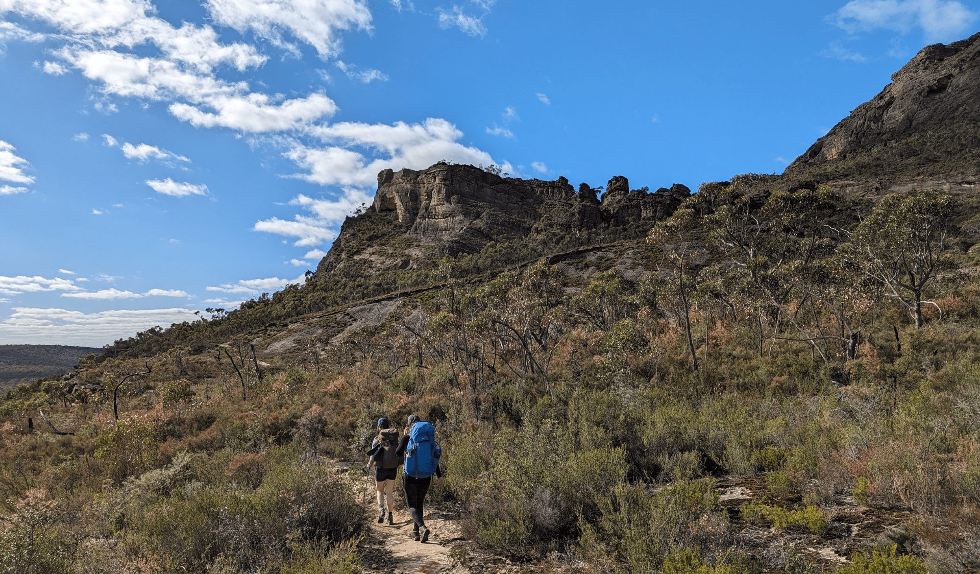
Begin your hike at the Gar Trailhead on Roses Gap Road (N2 on GPT topographic map). Along the 7.3-kilometre rugged, rocky track you'll experience steep climbs and panoramic views including the seasonal waterfalls of Gar.
As the trail zig zags upwards, you’ll see uninterrupted views to the north. You will climb through stunted eucalypt forest, past boulders and over rocky slabs on the edge of the Mount Difficult escarpment taking in views over nearby mountains, Wartook Valley, Asses Ears and the Black Range (Burrunj).
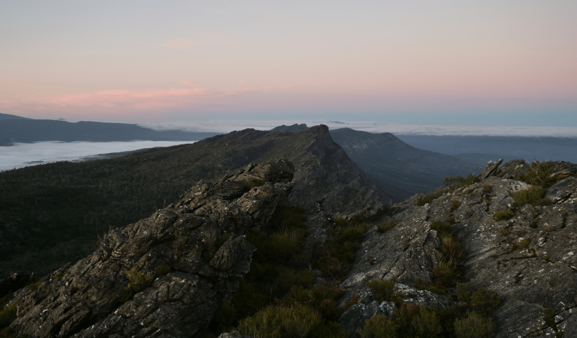
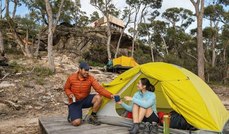
Arrive at the Gar Hike-in Campground, perched on a spectacular cliff top high above the valley below, where you’ll spend the night camped along the rocky terrace.
The climb to Gar Hike-in Campground
Day 2 – Gar Hike-in Campground to Werdug Hike-in Campground (via Gar)
Distance: 17km
Duration: 7 hours
Elevation: 738m
From the hike-in campground, take a side trip to the rocky summit of Gar (Mount Difficult). Enjoy the sunrise before traversing south towards Lake Wartook along rocky ridgelines.
The trail rises and falls over highpoints and through mountain saddles, before finishing on a high knoll at Werdug Hike-in Campground. The campground provides views over Lake Wartook and across the Mount Difficult Range.
Sunrise from Gar
Day 3 – Werdug Hike-in Campground to Halls Gap
Distance: 13km
Duration: 3.5 hours
Elevation: 244m
Start the morning off with a steady climb to Lake Wartook Lookout for spectacular views and a morning tea break.
To the west is Lake Wartook with Bear Island in the middle, the western Mount Difficult Range, Asses Ears and the Black Range (Burrunj) in the far distance. To the south, Mount William (Duwul) dominates the skyline, curving from The Sentinel at the northern tip around to the highest mountains in the park - Redman Bluff and including Mount William (Duwul) and the Major Mitchell Plateau massif.
Leaving the Lake Wartook lookout, make the descent passing rocky outcrops through lower vegetation with the last views over the Mount Difficult Range. Leaving the dry and rocky northern Grampians and moving onto the wetter eastern slopes, the trail gently descends through a canopy dominated by Messmate and Brown Stringybark with an open understorey featuring ferns, grasses, wattles and tea trees.
Take a short detour to Chatauqua Peak (Bim) before descending through tall forest, rich with birdlife and wildflowers, completing your journey in Halls Gap.
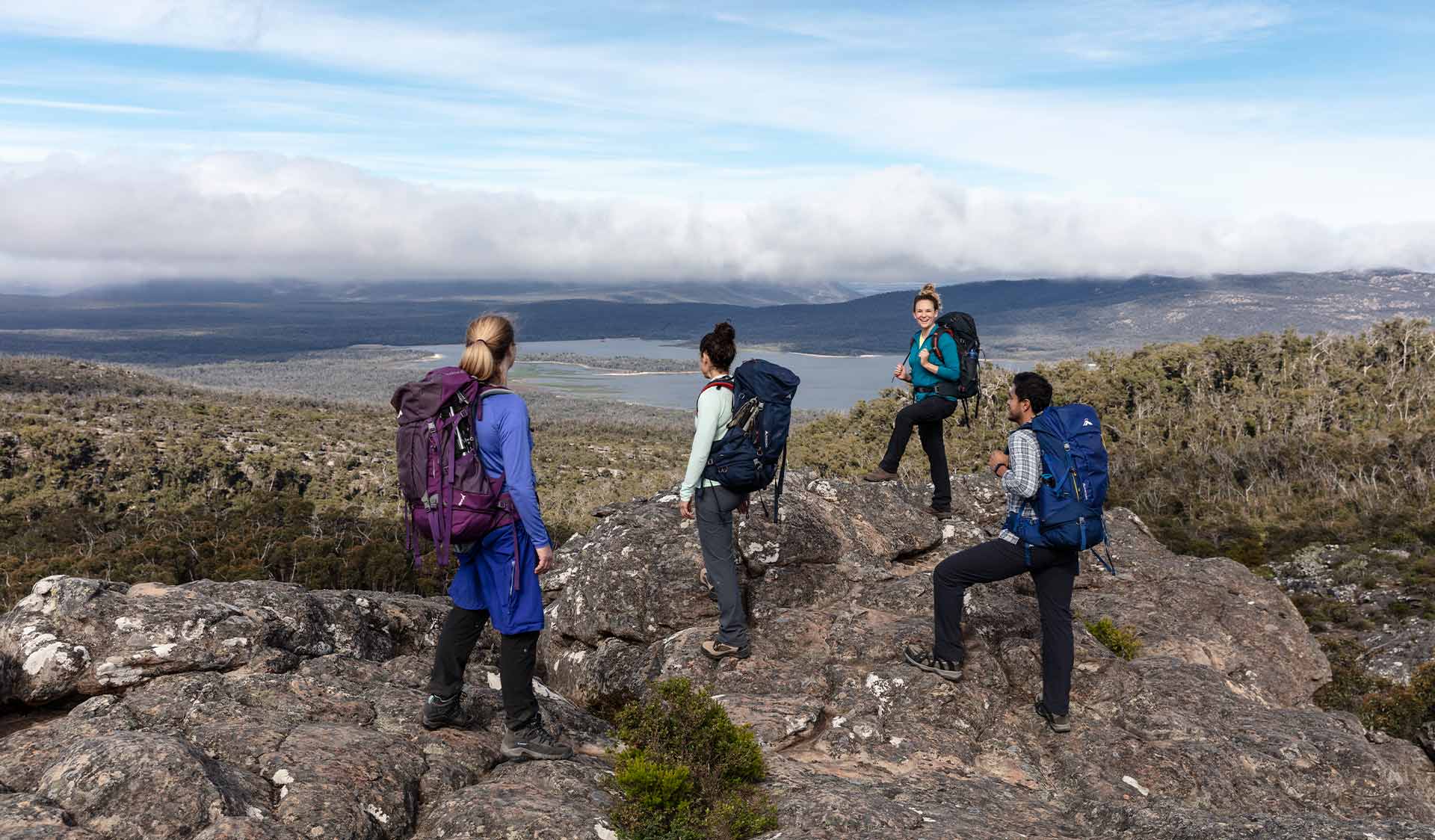
Lake Wartook Lookout
This 3-day hiking itinerary connects with the Barigar overnight hike to the north, as well as other tracks, so you can step on and off from various points throughout Gariwerd.
Gar and Werdug hike-in campground information
On this itinerary, you’ll spend your first night at Gar Hike-in Campground, and second at Werdug Hike-in Campground.
These campgrounds can be booked together as a 3-day/2-night itinerary at a cost of $103.60 for up to two people on a tent pad. Book now.
These fees contribute towards the operation and maintenance of this unique hiking experience and help to protect the environmental values of this heritage-listed national park.
We recommend booking your 3-day hike well in advance of your planned departure to ensure there is tent pad availability at each campground.
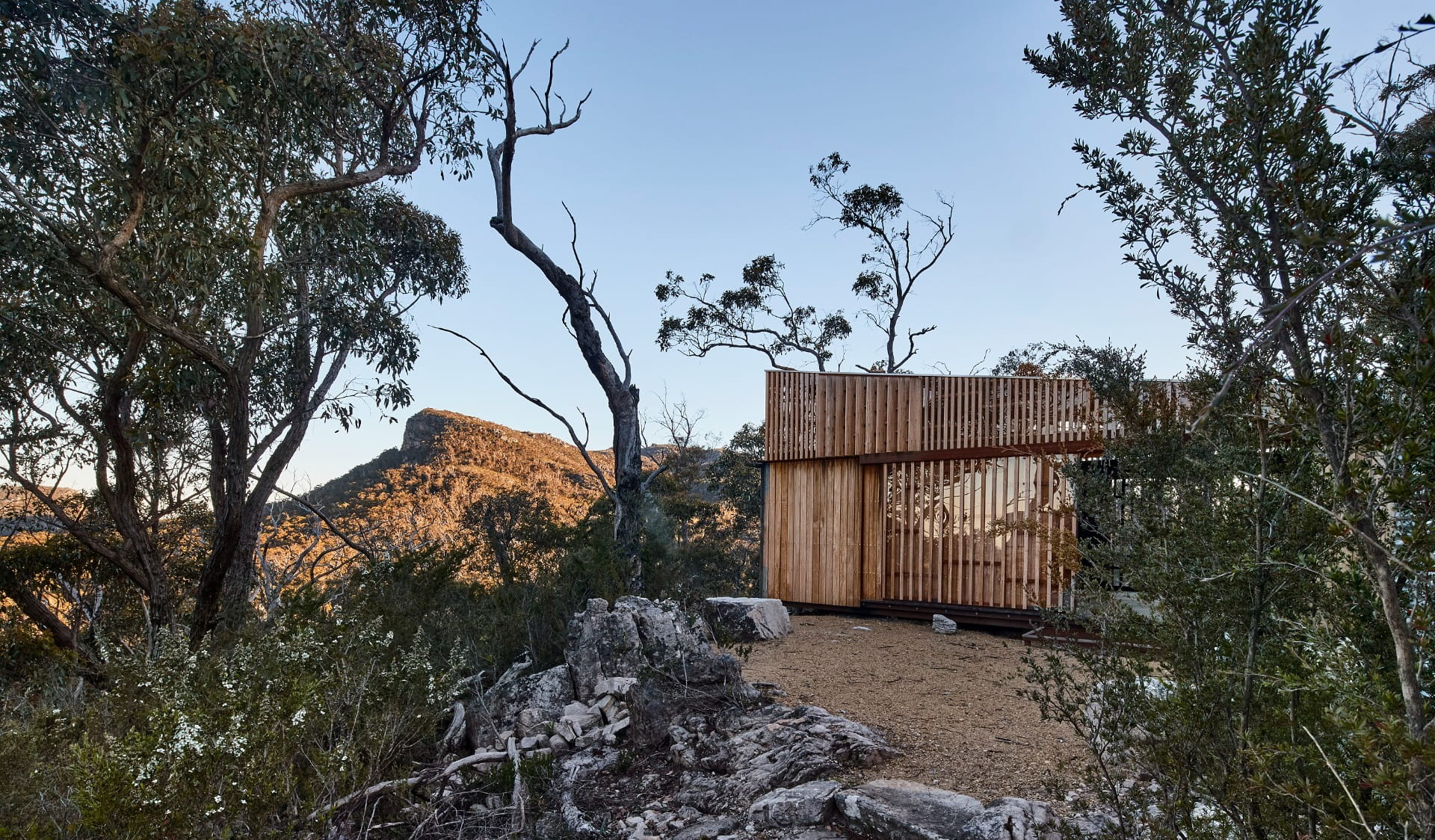
Each campground has been individually designed to fit within the surrounding landscape.
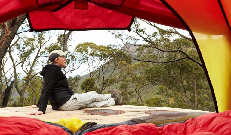
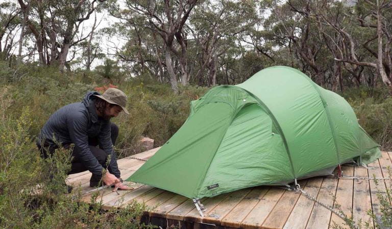
Both campgrounds have timber tent platforms (either 3.5m x 3.5m or 5.0m x 5.0m) with steel chains that can be used to secure your tent. Additional guy rope may be needed for tent vestibules or tunnel style tents.
There is an unpowered communal area for meal preparation with basic toilet facilities and water collection points. The use of fuel stoves in all hike-in campgrounds is permitted but open campfires are not allowed.
Please take your rubbish with you on the entire journey and dispose of it when you return home or finish your walk.
Important: mobile phone service is not available within the Wartook Basin, but you may get some along ridgelines and lower elevations.
Communal area at Werdug Hike-in Campground
Prepare for your adventure
Water safety
Plan and prepare
Change of park conditions
During the summer of 2024-2025, widespread bushfires impacted over 135,000 hectares in the central, west and south-eastern sections of Grampians (Gariwerd) National Park. For up-to-date information on what’s open and closed along the Grampians Peaks Trail, view change of conditions on the Grampians (Gariwerd) National Park page. For further information on the phased fire recovery program in Grampians (Gariwerd) National Park please visit the Grampians (Gariwerd) National Park Fire Recovery page.
How to get there
Gar and Werdug 3-day Hike
Need to know
Gar and Werdug 3-day Hike
Walking track grades
Hikes along the Grampians Peaks Trail have been graded using the Australian walking track grading system, which is a primary means of informing people about the features of walking tracks, so they can gauge their suitability for a particular track. Under the system, walking trails are graded on a difficulty scale from grades one to five.
Grade 1: No bushwalking experience required. Flat even surface with no steps or steep sections. Suitable for assisted wheelchair users.
Grade 2: No bushwalking experience required. A hardened or compacted surface which may have gentle hill sections or occasional steps.
Grade 3: Suitable for most ages and fitness levels. Tracks may have short steep sections, a rough surface and many steps.
Grade 4: Bushwalking experience recommended. Tracks may be long, rough and very steep. Directional signage may be limited.
Grade 5: Very experienced bushwalkers with specialised skills, including navigation and emergency first aid. Tracks likely to be very rough, very steep and unmarked.
Hiking tips for Grampians Peaks Trail
- An Official Grampians Peaks Trail topographic map (for North/Central/South) available from Brambuk the National Park and Cultural Centre, Halls Gap and other visitor outlets in nearby towns (and compass)
- Waterproof jacket and pants, thermal layers, breathable-fabric layers, beanie, sun hat and sunscreen.
- Hiking boots or shoes with a good tread and support.
- Water and food for all meals and snacks, plus extra for an emergency. Fuel stove for cooking.
- Drinking water treatment equipment for untreated water tanks at campground.
- 3-season tent, 3-season sleeping bag, mat and cord/thin rope to attach your tent to timber tent platforms.
- Lightweight gas or liquid fuel stove, matches/lighter, cooking pot and utensils.
- Head torch with spare batteries. Useful when moving around a campground at night.
- Good quality first aid kit with snake bite bandage.
- Mobile phone with USB cable – you can recharge at campgrounds along the trail. We also recommend taking a Personal Locator Beacon (PLB) for extra safety and a small radio to listen to weather or bushfire updates.
- Toilet paper, trowel and a bag to carry your rubbish.
- Waterproof pack liner to keep everything in your hiking backpack dry.
Be bushfire aware
The warmer months are the perfect time to experience regional Victoria. However, Victoria is one of the most fire-prone areas in the world. During summer in Victoria, the weather can be very hot and dry and the risk of summer lightning storms can increase the chance of bushfires.
Follow these bushfire safety tips to ensure that your experience is safe and enjoyable.
Change of Conditions
Nature being nature, sometimes conditions can change at short notice. It’s a good idea to check this page ahead of your visit for any updates.
-
Grampians (Gariwerd) National Park
Rockclimbing Access Changes - Centurion Walls, Tortoise Wall
Re-discovery of cultural heritage at two designated rock-climbing sites in Grampians (Gariwerd) National Park has resulted in changes to access.Centurion WallsSignificant Aboriginal cultural values were rediscovered at Lower Centurion in late 2025. As a result, a partial closure is now in place, ensuring cultural heritage protection while maintaining modified climbing access for visitors. On-ground signage at the access track clearly delineates where climbing is or isn’t permitted.Visitors are advised:- Access is closed from the
area north of and including Damage Done. These sites include:
Damage Done, Shades of Black, Liberator, Lexicon, Temuujin, Killer Wolf, Devilled Haircut, Compressor route, Anti-Christ Superstar, Pining for the Fiords, Unknown Route 2, Genghis Khan, Project KP2, Project KP, Kublai Khan, Stone Temptress, Psychotic Episode, Trail of the dead, Flood the Zone, Push it Upstairs, Progressive Happy House.
- All climbs south of and
including In Plain Sight remain open. These climbs include; In Plain Sight, Who
Dreams of Cats, Who Dreams of Cats – short, Nowhere to Hide,
Afterworld, Left Hand Black, Centrifugal Force, Centrifugal Force –
Romanes Eunt Domas (linkup), Romanes Eunt Domas, Black Nobility, Sandpit,
Ton Steine Scherben, Winged Corpse, HCP, Massacres and Maniacs, Lunchbox
Legend, and AA New Rope / New route.
- Access to Upper Centurion
remains unchanged and is via the south end near Winged Corpse.
Tortoise WallWe’re currently asking visitors to not access the area known as ‘Tortoise Wall’ to avoid causing potential harm to Aboriginal cultural heritage that was rediscovered in April 2026. A temporary closure is now in place, while Parks Victoria and Gariwerd Traditional Owners determine a longer-term management response. Out of respect for this significant cultural landscape, visitors are requested to not access this area.For further information visit the 'rock climbing in Gariwerd' web page https://www.parks.vic.gov.au/places-to-see/parks/grampians-national-park/rock-climbing-in-gariwerdTemporary closure of a Glenelg River Road section – 25 May to 26 June 2026
The section of Glenelg River Road from the Stony Creek Road intersection to the Boreang Campground turn off will be closed from Monday 25 May 2026 to Friday 26 June 2026 for roadworks.The southern end of the closure can be accessed via Rose Creek Road. Paddy Castle walk and Boreang Campground remain open, as does Glenelg River Road, south of Lodge Road.Mount Victory Road will have an increased amount of heavy trucks and machinery. Drivers are urged to slow down and drive with care, particularly in tight corners.Please refer to the map provided for detour information. For further information please contact Brambuk the National Park and Cultural Centre Phone 8427 2058.
Grampians (Gariwerd) National Park - Roads Update 02.06.2026
The Grampians (Gariwerd) National Park has roads temporarily closed due to bushfire and weather impacts.Please be aware the movement of visitors in parts of the National Park is restricted.Ongoing RoadworksGlenelg River RdThe section of Glenelg River Road from the Stony Creek Road intersection to the Boreang Campground turn off will be closed from Monday 25 May 2026 to Friday 26 June 2026 for roadworks.The southern end of the closure can be accessed via Rose Creek Road. Paddy Castle walk and Boreang Campground remain open, as does Glenelg River Road, south of Lodge Road.Likely increased traffic on Rose Creek Road. Also trucks carting materials near Syphon Road.Recent OpeningsMitchell RdRecent ClosuresLodge Rd – from Rose Creek Rd to Red Rock RdSyphon Rd – from Goat Tk to Lodge RdMatthew Tk – early seasonal closureUpcoming Seasonal Road Closures will be in place from the 9 June 2026 to 29 October 2026.For more detail, please refer to the attached up-to-date road report attached.Attachments: Grampians (Gariwerd) National Park - Road Report 02.06.2026 (238KB)
Event Notification – Grampians Gariwerd National Park June 6-7, 2026
Serra Terror Endurance ChallengeSerra Terror is a 2-day endurance team challenge taking place over the King’s Birthday long weekend onJune 6 & 7, 2026.Park visitors may encounter event participants and support crew, traffic management, signage and other infrastructure along the route from Halls Gap to Miranatwa via the Wonderland Range, Moora Reservoir, Moora Channel, Victoria Range and Victoria Valley.Please drive with care around checkpoints and look out for parked vehicles, hikers, and event Marshalls.For further detail on checkpoint locations, course maps and event timing please visit https://www.serraterror.com/ - Access is closed from the
area north of and including Damage Done. These sites include:
-
Mackenzie Falls Day Visitor Area (Grampians (Gariwerd) National Park)
Mackenzie Falls (Migunang wirab) – Closed for major construction works – 9 February 2026 to midyear 2026
Construction work at Mackenzie Falls in the Grampians (Gariwerd) National Park is underway and the carpark and precinct is closed to visitors.The works at Mackenzie Falls precinct includes the construction of a new viewing platform at the base of the falls, upgrades to the carpark and the Bluff Lookout Walk and other important safety improvements to stabilise rock and improve walking tracks.
The Mackenzie Falls carpark and all walking tracks in the precinct including Broken Falls Walk, Mackenzie Falls Walk to the base (from the carpark) and the Bluff Lookout Walk are all closed. We anticipate that construction work will finish in the second half of the year.The carpark will be a construction site throughout the works period with large machinery operating and materials being stored on site. There will be no access for all vehicles or visitors at Mackenzie Falls Precinct during construction.Zumsteins Picnic Area ParkingDuring construction parking at the popular Zumsteins picnic area will be limited. It is not recommended for large passenger coaches and long caravans to visit during construction. Similarly, they should not travel between Mackenzie Falls and Zumsteins due to the narrow winding road.A small amount of parking for campervans, small motorhomes and cars with trailers is available opposite the Zumsteins Picnic Area car park, however, may not be available on busy weekends and public holidays.Zumsteins to Fish Falls – This popular walk to the beautiful Fish Falls is a 1.5 to 2 hour return walk (Grade 3) – walkers should have a reasonable fitness level, carry water and wear sturdy walking shoes as the track can be rocky with uneven surfaces and some steep sections.Mackenzie River Walk – There will be no access to the base of Mackenzie Falls from Zumsteins Picnic Area from 27 April 2026 until construction works are complete. Fish Falls will still be accessible from Zumsteins Picnic Area.For further information on the Mackenzie Falls (Migunang wirab) project visit https://www.parks.vic.gov.au/projects/western-victoria/mackenzie-falls-revitalisationPopular day visitor sites such as Reeds Lookout, the Balconies, Boroka Lookout, Silverband Falls and various walks with large bus carparking will still be available.For further information contact Brambuk the National Park and Cultural Centre in Halls Gap (Ph 8427 2058).Please keep up to date with closures through the Change of Conditions page for Grampians (Gariwerd) National Park. -
Billimina Walk (Grampians (Gariwerd) National Park)
Billimina Walk – Temporary closure
Billimina Walk and Rock Art Shelter remain closed to visitors due to track damage from the 2024/25 summer bushfires.An alternative walk in this area is the Manja Walk to the Manja Shelter, which is an Aboriginal Rock Art site in the Victoria Range.For more information visit Brambuk the National Park and Cultural Centre in Halls Gap or call 03 8427 2058. -
The Fortress Walk (Grampians (Gariwerd) National Park, Victoria Range Remote and Natural Area)
The Fortress Walk and Hike-in Campground – Temporary closure
The Fortress Walk and The Fortress Hike-in Camp remain closed to visitors due to track damage from the 2024/25 summer bushfires.For more information on alternate walks in the western section of the Grampians (Gariwerd) National Park visit Brambuk the National Park and Cultural Centre in Halls Gap or call 03 8427 2058. -
The Chimney Pots Walk (Victoria Range Remote and Natural Area, Grampians (Gariwerd) National Park)
The Chimney Pots Walk – Temporary closure
The Chimney Pots Walk remains closed to visitors due to track damage from the 2024/25 summer bushfires.For more information on alternate walks in the western section of the Grampians (Gariwerd) National Park visit Brambuk the National Park and Cultural Centre in Halls Gap or call 03 8427 2058. -
Red Gum Walk (Grampians (Gariwerd) National Park)
Red Gum Walk – Temporary closure
The Red Gum Walk remains closed to visitors due to track damage from the 2024/25 summer bushfires.For more information on alternate walks in the western section of the Grampians (Gariwerd) National Park visit Brambuk the National Park and Cultural Centre in Halls Gap or call 03 8427 2058. -
Mafeking Picnic Area (Grampians (Gariwerd) National Park)
Mafeking Picnic Ground and Brownings Loop Walk – Temporary closure
Mafeking Picnic Area and Brownings Loop Walk remain closed to visitors due to damage from the 2024/25 summer bushfires.For more information visit Brambuk the National Park and Cultural Centre in Halls Gap or call 03 8427 2058. -
Strachans Campground (Grampians (Gariwerd) National Park)
Strachans Campground –Temporary Closure – 13 April – 25 June 2026
Strachans Campground will be closed to visitors for major upgrade works from 13 April to 25 June 2026.Alternative campgrounds can be booked at https://bookings.parks.vic.gov.au/bookFor further information contact Brambuk the National Park and Cultural Centre in Halls Gap (Ph 8427 2058). -
Brambuk the National Park and Cultural Centre (Grampians (Gariwerd) National Park, Brambuk - The National Park and Cultural Centre Park)
Brambuk the National Park and Cultural Centre – Building Upgrades in 2026
The Cultural Centre is closed for refurbishment.Parks Victoria is working with a strategic partnership committee of Gariwerd Traditional Owners from Barengi Gadjin Land Council, Eastern Maar Aboriginal Corporation, and Gunditj Mirring Traditional Owners Aboriginal Corporation to ‘reimagine’ the future of Brambuk the National Park and Cultural Centre.Building upgrades are essential to ensure the centre meets current services requirements, accessibility, and compliance to current building regulation. New visitor experiences and activation opportunities including Aboriginal arts, community events and cultural exhibitions are being explored as Brambuk moves towards operation by a Gariwerd Traditional Owner entity.The National Park Information Centre and gift shop remain open.For up-to-date national park information, brochures, maps, permits and access advice contact information staff at Brambuk the National Park and Cultural Centre info@parks.vic.gov.au or phone 8427 2058For Junior Ranger School holiday programs visit https://www.parks.vic.gov.au/things-to-do/junior-rangersFor a list of Grampians (Gariwerd) National Park Licensed Tour Operators Visit https://www.parks.vic.gov.au/ltoFurther details on the Brambuk Reimagining project can be found on the Parks Victoria website https://www.parks.vic.gov.au/projects/western-victoria/brambuk-cultural-centre-upgrade -
Notices Affecting Multiple Parks
Pest Animal Control Program Scheduled in Grampians (Gariwerd) National Park and Black Range State Park (Burrunj)
Throughout June, a ground shooting program (involving firearms) will occur throughout Grampians (Gariwerd) National Park and Black Range State Park- Grampians (Gariwerd) National Park: Every
week of June
- Black Range State Park (Burrunj): 22nd June and
25 June
The program will be delivered at night between 6pm to 5am, in remote areas away from busy visitor sites, and will be carried out by professionals under strict conditions to ensure practices are safe, effective, and humane.There will be no visitor site closures as part of this operation. Areas will be thoroughly assessed and swept prior, but there may be signage in place to notify visitors of the operation occurring in the surrounding area.Target species include deer and goats which cause serious damage to native plants, animals, and habitat by trampling and destroying plants, increasing grazing pressure, ring-barking young trees, fouling waterholes, causing soil erosion, and spreading weeds. Introduced predators (foxes and cats) prey on small mammals and reptiles and impact the ability of these species to recover from bushfire events.For further information, please contact Brambuk the National Park and Cultural Centre at brambuk@parks.vic.gov.au - Grampians (Gariwerd) National Park: Every
week of June
Add more Grampians Peaks Trail hikes to your itinerary
Bugiga and Barri Yalug 3-day Hike
Djardji-djawara and Mud-dadjug 3-day Hike
Duwul and Durd Durd 3-day Hike