Explore
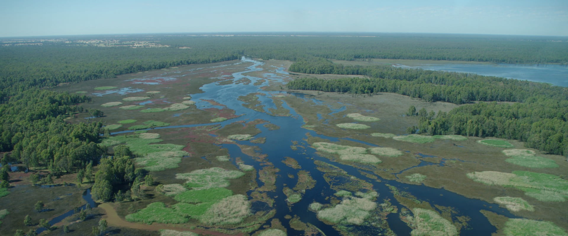
Barmah National Park
“Gulpa Gaka Anganya – Gaka Yawal Ngulla Yenbena Yorta Yorta Woka,” welcome friend – come walk with us the people on Yorta Yorta Country. Barmah National Park is on the lands of the Yorta Yorta people, and they ask that you treat it with respect and care for it as an extension of yourself. Explore the park via the walking trails through the forests and along the waterways, following pleasant winding creeks and the Murray River. Visitors can see remnants of the long heritage and use of this landscape by the Traditional Owners in the various oven mounds used for cooking. These are found along the Lakes Loop Track and Broken Creek Loop Track. The waters of this park are popular for fishing, swimming, boating and canoeing. Visitors can choose from one of the many camping areas along the river within the Dungalla (Murray River) zone of the park.
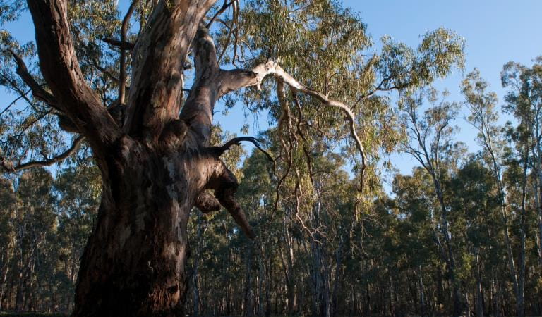
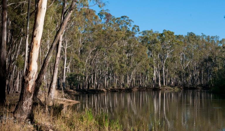
The park protects 38 rare or threatened plants, including Fruit Saltbush and Winged Peppergrass. Yellow and Grey Box grow on the ridges. River Red Gums line the Murray River and lower lying areas, and these iconic trees can reach 45m and live for more than 500 years. The trees need periods of flooding and can survive inundation for months. Their seeds are washed onto higher ground during a flood, where they germinate and grow before the next flood reaches them.
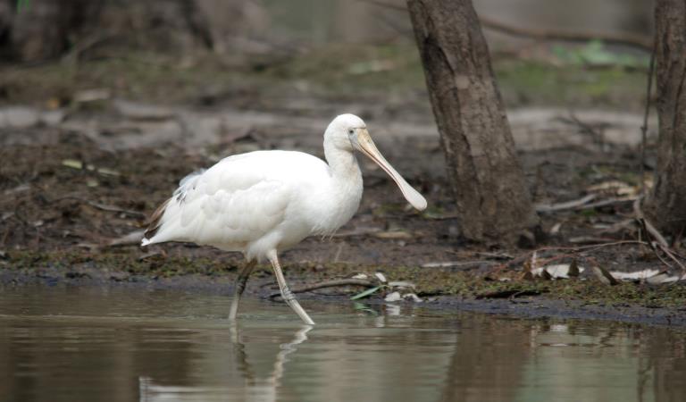
Hollows and broken branches provide nesting for galahs, cockatoos, cockatiels and various parrots. The park is even more to a healthy population of the endangered superb parrot. The forest also provides important habitat for waterbirds, with more than 200 species of birds recorded here. It is one of Victoria’s largest waterbird breeding areas. Birdwatchers can spot a number of captivating species, including Brolgas, Night Herons, Spoonbills, Sea Eagles and Azure Kingfishers. Other wildlife abounds throughout the forest, where Grey Kangaroos, Emus and Koalas are common.
Things To Do
Yamyabuc Discovery Trail
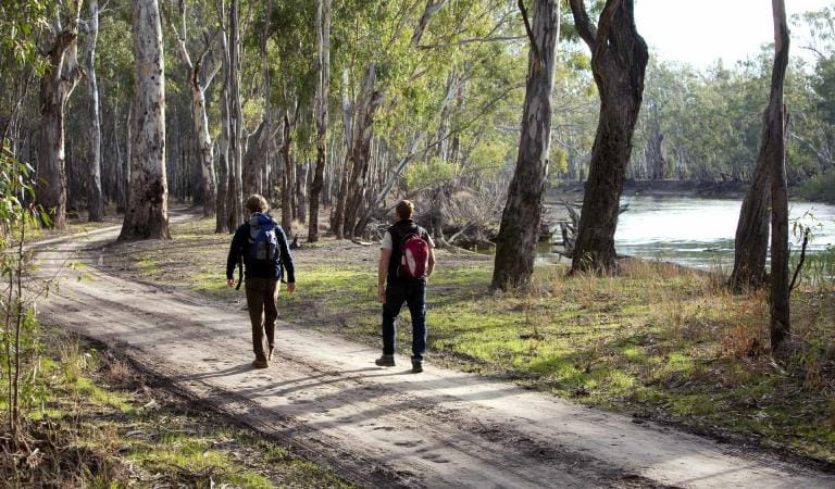
Lakes Loop Track
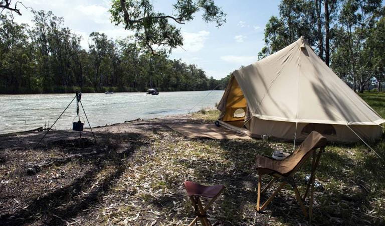
Camping in Barmah National Park
Birdwatching in Barmah National Park
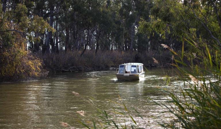
Boating, canoeing and fishing in the park
Swimming in Barmah National Park
Barmah National Park
This area is well known for its wildlife. Keep an eye out for:
Tours and adventure experiences in parks
One of the best ways you can get into nature is with a Licensed Tour Operator.
There are more than 400 Licensed Tour Operators across Victoria who are ready and waiting to help you experience and connect with Victoria’s spectacular parks and waterways.
Discover more than 60 different types of nature-based experiences including hiking, mountain biking, boating, four-wheel driving, indigenous culture tours, birdwatching, surfing, diving and so much more.
Licensed Tour Operators know all the best places to go and will plan and prepare your visit to ensure you are safe and can enjoy your nature-based adventure to the fullest.
How to get there
Barmah National Park
When you're there
Need to know
Barmah National Park
Accessibility
Visiting a park can be more of a challenge for people with disabilities, however in Victoria there are a wide range of facilities to help people of all abilities enjoy our wonderful parks around the state.
Assistance dogs are welcome in Parks Victoria parks and reserves. Entry requirements apply for parks and reserves where dogs are normally prohibited, such as national parks.
Safety in nature
To ensure that you and your companions stay safe, always remember that the natural environment can be unpredictable. Before you go, take a look at our safety tips and check our changed conditions and closures information for a great visit.
How we keep it special
The River Red Gum Conservation Action Plan provides directions for environmental conservation management across the diverse landscape, including Barmah National Park. This covers a variety of dry and riverine forests and woodlands, and freshwater and saline wetlands supported by the Murray River.
Visitor guidelines
- Firearms, dogs, cats and other pets are not permitted in the park.
- All plants, animals, other natural features and cultural sites are protected and must not be disturbed or removed.
- Collect only dead wood from the ground for campfires.
- Vehicles, including motor bikes, may only be used on formed open roads. Drivers must be licensed and vehicles registered and roadworthy.
- Feeding wildlife is bad for their health. It is an offence to feed or leave food where it is accessible to wildlife. Penalties apply. Store all food securely and properly dispose of all rubbish, including food scraps.
Murray River Adventure Trail
Stage One of the long-distance nature-based Murray River Adventure Trail will encompass a series of new and upgraded trails and other facilities from Barmah National Park (near Picnic Point) to Koondrook. The trail will pass through Lower Goulburn National Park, Gunbower National Park, Murray River Reserve and Echuca.