Grade 5

Grampians National Park is part of the Gariwerd Aboriginal cultural landscape. Parks Victoria respects the deep and continuing connection that Traditional Owners have to these lands and waters, and we recognise their ongoing role in caring for Country.
![]()
![]()
![]()
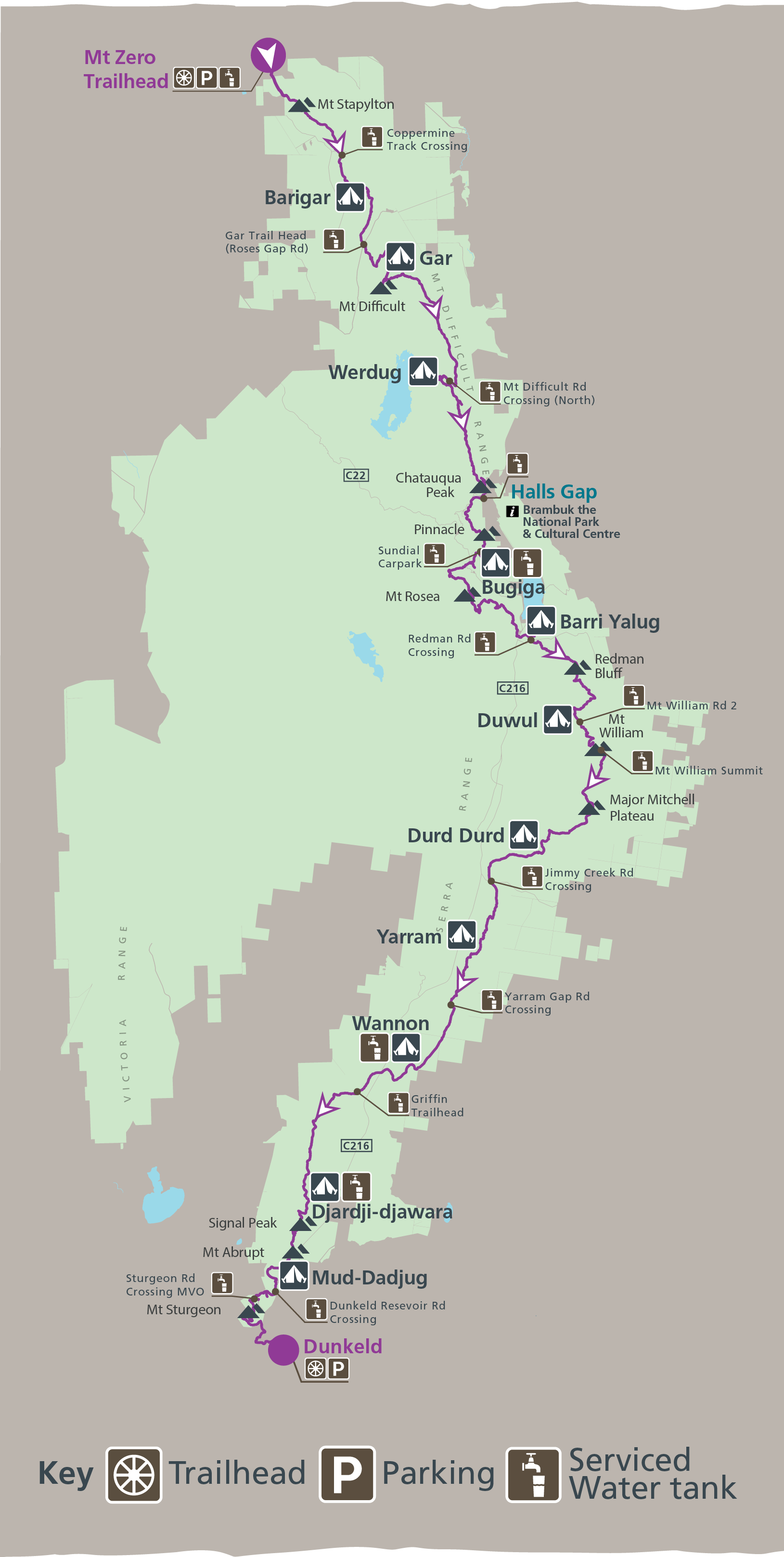
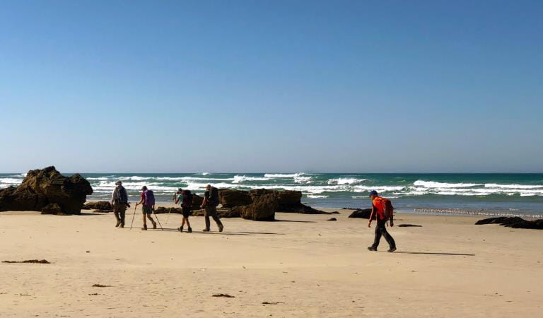
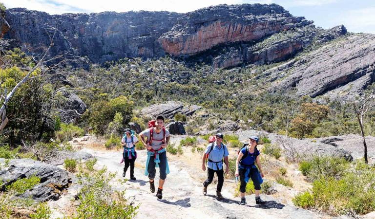
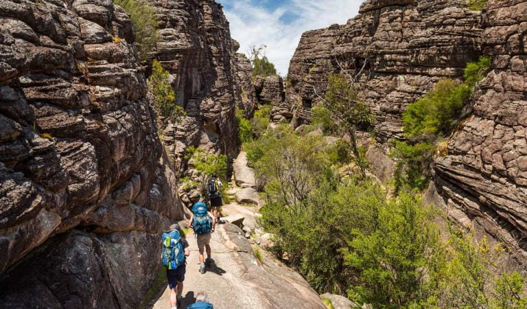
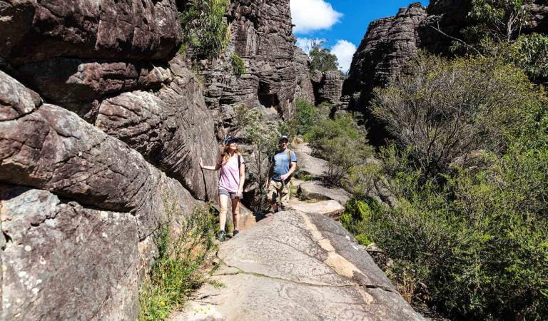
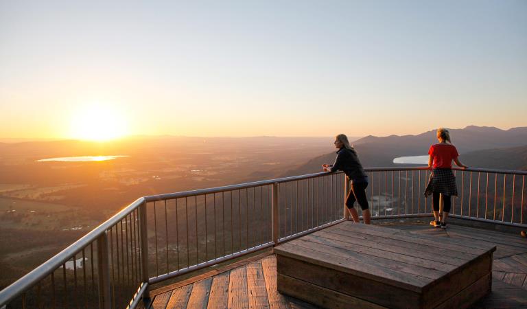
The full Grampians Peaks Trail is a challenging 164km, once-in-a-lifetime hiking experience. If you’re bold and committed to completing this 13-day/12-night hike, you will have an unforgettable adventure and be rewarded with some of the best hiking trails and panoramic views in Australia. This is a very difficult Grade 4 and Grade 5 trail with steep terrain and suitable only for experienced long-distance hikers. See GPT topographic map for section references: N1-N4; C1-C5;S1-S4.
When planning this incredible hike, read the Grampians Peaks Trail Plan and Prepare Guide and order the official topographic maps from Brambuk the National Park and Cultural Centre in Halls Gap.
See the Water Information and Availability page for more information on specific locations of serviced water tanks along the trail. They are mentioned below and included on the official GPT maps, and the above web page includes the map coordinates.
Day 1: (N1) Mt Zero – Barigar Hike-in Campground
Start: at Mt Zero Picnic Area. Distance: 12.1km Grade: 4
Key elevation points: Mt Zero Carpark 250m, Mt Stapylton 518m, Barigar Hike-in Campground 230m
Names and meanings: Barigar = ‘Parigar’: mountain stream. Gar = pointed mountain, Bar = river, hence mountain stream.
Highlights: Ridgeline hiking, Taipan Wall, Mt Stapylton viewpoint and seasonal rockpools and waterfall.
A day of ridgeline hiking around and under boulders and crossing open rocky slabs. Expect views of Stapylton Amphitheatre, Mt Stapylton (Gunigalg) and the magnificent orange wave of Taipan Wall. Watch for the aptly-named Bird Rock and early season spring wildflowers. Hike through low forest and dense shrub to Golton Creek and on to Coppermine Track. From here climb to exposed rocky battlements then hike downhill towards a high wind-blown cave and creek crossings over open rock slabs dominated by boulders with small seasonal rockpools. Look ahead to the dramatic Mt Difficult Range. A steep descent to a scenic seasonal waterfall (after rain) heralds your arrival at Barigar Hike-in Campground.
Important safety information:
- Serviced water tanks at Mt Zero Trailhead and Coppermine Track Crossing
- Rainwater tank at Barigar Hike-in Campground
Day 2: (N2) Barigar Hike-in Campground – Gar Hike-in Campground
Start: Barigar campground Distance: 11.3km Grade:4
Key elevation points: Barigar 230m. Mt Difficult (Gar), 806m, Gar Hike-in Campground 700m
Names and meanings: Barigar = ‘Parigar’: mountain stream. Gar = pointed mountain, Bar = river, hence mountain stream.
Highlights: Seasonal waterfalls (after rain), a heath covered plateau, Mt Difficult (Gar) mountain summits.
Hike uphill from Barigar passing through grassy woodland. A final switchback up rock steps brings you to a ridgeline with extensive views of the Mt Difficult Range, and an easy descent to Roses Gap Road. Spring wildflowers, Yellow Box eucalypts and Grampians Thryptomene feature on the lower slopes. A steady hike follows Dead Bullock Creek up the imposing Mt Difficult Range escarpment. Enjoy stunning waterfalls after rain. The trail gets harder as it steepens, zig-zagging upwards on steep rocky steps, close to cliff edges and below massive rock walls before reaching the Gar Hike-in Campground. Gar = ‘big mountain’, is the highest on the western side of the Range.
Important safety information:
- Rainwater tanks at Barigar and Gar Hike-in Campgrounds
- Serviced water tank at Gar Trailhead (Roses Gap Rd)
Day 3: (N3) Gar Hike-in Campground – Werdug Hike-in Campground
Start: Gar hike in campground Distance: 14.0km Grade: 4
Key elevation points: Gar Hike-in Campground 700m, Werdug Hike-in Campground 750m
Names and meanings: Gar = pointed mountain. Werdug = ‘Werdook’: his shoulder, a reference to the shoulder of a mythical ancestor.
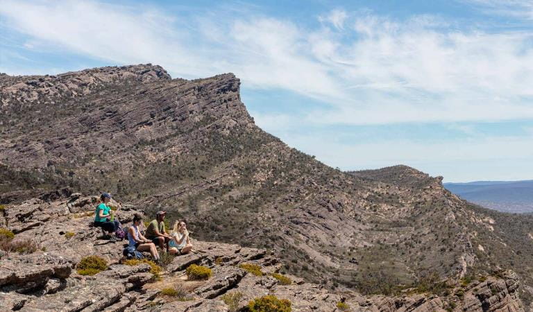
Highlights: Mt Difficult (Gar) summit, open rock slabs, elevated ridgeline views from the backslopes of the Mt Difficult Range.
A day hiking around the horseshoe shaped mountain range encircling the Lake Wartook basin below. The trail rises and falls over highpoints, dipping through saddles and crossing bare rocky slabs on its way to Long Gully Creek. Werdug Hike-in Campground is perched on a high knoll with clear day views down into Lake Wartook and across to the western Mt Difficult Range.
Important safety information:
- Rainwater tanks at Gar and Werdug Hike-in Campgrounds
- Serviced water tank at Mt Difficult Rd Crossing (North) shortly before Werdug Hike-in Campground
Day 4: (N4) Werdug Hike-in Campground – Halls Gap (own arrangements)
Start: Werdug Hike-in Campground Distance: 13.0km Grade: 4
Key elevation points: Werdug Hke-in Campground 750m Lake Wartook lookout, Halls Gap 230m
Names and meanings: Werdug = ‘Werdook’: his shoulder, a reference to the shoulder of a mythical ancestor.
Highlights: Sweeping views, rocky gardens and a descent through tall wet forest and winter/spring wildflowers.
Lake Wartook Lookout (829m) is one of the highest points in the Mt Difficult Range. Climb to Lake Wartook Lookout, before meandering across the escarpment passing rocky gardens and descending steep stone steps. They herald the first major vegetation transition as you leave the dry, open rocky northern area and move down through the wetter eastern slopes. Listen for birdlife in this area as you hike through tall forest and an open understorey with ferns, grasses, wattles and tea trees. Chautauqua Peak gives views over the town before the final descent past Clematis Falls (seasonal rains) and through the Botanic Gardens on the approach into Halls Gap.
You need to book your own accommodation (off-trail) for this night. Halls Gap offers a variety of accommodation for walkers, for further information go to Visit Grampians.
Important safety information:
- Rainwater tank at Werdug Hike-in Campground.
- Fill with extra water at Werdug Hike-in Campground as there are no serviced water tanks along the trail until you get to Halls Gap.
Day 5: (C1) Halls Gap to Bugiga Hike-in Campground
Start: Halls Gap Trailhead (caravan park) Distance: 8.9km Grade: 4
Key elevation points: Halls Gap 230m, The Pinnacle, 715m, Bugiga Hike-in Campground 625m
Names and meanings: Bugiga = ‘Bukika’: Unknown – refers to Mount Rosea (Bugiga-mirgani = ‘Bukika-mirkani’).
Highlights: Stony Creek, Grand Canyon, The Pinnacle.See fascinating sandstone gorges and gnarly, weathered rock formations in the Wonderland Range. Near Venus Baths are views of Elephants Hide and, in the background, Chautauqua Peak.
The sculpted rock shapes in the Grand Canyon and Silent Street will intrigue you before you exit up and out towards the Pinnacle Lookout, passing the Cool Chamber and Bridal Veil Falls on the way. Hike from the rocky ridges down through forest towards Sundial Carpark, through to Devils Gap and on towards Lakeview Lookout and past Sundial Carpark. Arrive at the stunning Bugiga Hike-in Campground, looking up towards the rugged cliff-line of Mt Rosea.
Important safety information:
- Serviced water tanks at Sundial Carpark and Bugiga Hike-in Campground
Day 6: (C2) Bugiga Hike-in Campground – Barri-Yalug Hike-in Campground
Start: Bugiga Hike-in Campground Distance: 14.7km Grade: 4
Key elevation points: Bugiga Hike-in Campground 625m, Mt Rosea, 1009, Barri-yalug Hike-in Campground 375m
Names and meanings: Bugiga = ‘Bukika’: Unknown – refers to Mount Rosea (Bugiga-mirgani = ‘Bukika-mirkani’). Barri Yalug = ‘Parri yalook’: running river.
Highlights: Wet tall forest with a rocky steep climb through boulders to the Mt Rosea (Bugiga-mirgani) ridgeline. Cross the bridge at the Gate of the East Wind.
Climb through tall forest and onto the slopes of Mt Rosea. After reaching the summit, a long descent through tall forest leads to a footbridge over Fyans Creek next to Borough Huts, a great place for a cool-off. Workers lived at Borough Huts and maintained Stawell’s water supply in the late 1800s. The ingenious, elevated steel flume carried gravity-driven water along the Mt William Range before passing through a hand-hewn tunnel and on into Stawell. Cross Grampians Tourist Road and walk through forest and onto rocky slopes to Barri Yalug.
Important safety information:
- Serviced water tank at Bugiga Hike-in Campground
- Rainwater tank at Barri-Yalug Hike-in Campground
Day 7: (C3) Barri-Yalug Hike-in Campground – Duwul Hike-in Campground
Start: Barri yalug Hike-in Campground. Distance: 13.2km Grade: 4
Key elevation points: Barri-yalug Hike-in Campground 375m, Mt William 1167m, Duwul Hike-in Campground
Names and meanings: Barri Yalug = ‘Parri yalook’: running river. Duwul = ‘Duwil’: the mountain.
Highlights: The biggest elevation change of all the GPT: Barney Creek (320m) to Redman Bluff (1017m).
Climb toward Seven Dials passing a section of historic raised water-fluming held up by dry stone pillars, large open rock-covered areas and moss beds. Descend Seven Dials and climb towards Redman Bluff (1017m high), marked by an historic rock cairn. Walk down from Redman Bluff and watch for a picturesque tea tree surrounded pond located at a small plateau. Hike a small corridor between the Mt William Road and the cliff edge before reaching Duwul Hike-in Campground.
Important safety information:
- Rainwater tanks at Barri-Yalug and Duwul Hike-in Campgrounds
- Serviced water tanks at Redman Rd Crossing and Mt William Road 2.
Day 8: (C4) Duwul Hike-in Campground – Durd Durd Hike-in Campground
Start: Duwul Hike-in Campground Distance:14.5km Grade: 4
Key elevation points: Durd Durd Hike-in Campground 855m
Names and meanings: Duwul = ‘Duwil’: the mountain. Durd Durd = ‘Durt Durt’: stars.
Highlights: Mt William (Duwul) summit; 400m. The park’s highest mountain with views of the Serra Range and Victoria Ranges.
Climb to Mt William (1167m) then head south to Boundary Gap (878m) separating Mt William from the Major Mitchell Plateau. A challenging ‘big dipper’ that must be endured. The Major Mitchell Plateau undulates across rocks and steel mesh walkway, passing First Wannon Creek and reaching the highest point on the plateau, Durd Durd (1167m), marked by a rock cairn. Continue south to Banksia Hill (1103m), across the banksia ridgeline where the trail rock-hops across large boulders before descending to an open grassy woodland, reminiscent of an alpine meadow.
Important safety information:
- Rainwater tanks at Duwul and Durd Durd Hike-in Campgrounds
- Serviced water tank at Mt William Summit
Day 9: (C5) Durd Durd Hike-in Campground – Yarram Hike-in Campground
Start: Durd Durd Hike-in Campground Distance: 11.9km Grade: 4/5 Key elevation points: Durd Durd 1,167m, Durd Durd Hike-in Campground 855m
Names and meanings: Durd Durd = ‘Durt Durt’: stars. Yarram = ‘Yarram’: big.
Highlights: Wildflowers, landscape views to the east and west.
A new landscape unfolds as you descend from the highest mountain peaks down into sheltered woodland valleys. Passing through previously untracked areas of the lower Mt William range, it offers up some of the most rugged ridgeline rock walking and jagged Serra Range views. This section is fantastic for late winter and spring wildflowers. Watch for the red “spider flowers” of Flame Grevillia, typically in bloom between April and November. To the east is the area’s farmland and scattered lakes and wetlands – important habitat to wildlife, including threatened species such as Australia’s largest flying bird, the Brolga.
Important safety information:
- Rainwater tanks at Durd Durd and Yarram Hike-in Campgrounds
- Serviced water tanks at Jimmy Creek Rd Crossing and Jimmy Creek Campground
Day 10: (S1) Yarram Hike-in Campground – Wannon Hike-in Campground
Start: Yarram Hike-in Campground Distance: 11.1km Grade: 4/5
Names and meanings: Yarram = ‘Yarram’: big. Wannon = ‘Wannon’: may be a corruption of the word for digging stick or boomerang.
Highlights: Serra Range views, rocky knolls, Mt Nelson (819m) to the west in the Serra Range and wildlife, including night calls of owls, possums and gliders.
Descend and climb knolls and saddles passing through ancient old growth forests and lower swampland plains with stands of native Oyster Bay Pines along the way. Take in views of farmland to the east and south-east that reveal a myriad of swamps, lakes and wetlands and the dramatic Serra Range to the west. Continue hiking the ups and downs of the most southern ridgeline of the Mt William Range, which undulates like a roller-coaster. Settle in Wannon Hike-in Campground for the night in a reclaimed farmland gully. Explore surrounding ridges for stunning sunset views.
Important safety information:
- Rainwater tanks at Yarram and Wannon Hike-in Campgrounds
- Serviced water tank at Yarram Gap Rd Crossing
Day 11: (S2) Wannon Hike-in Campground – Djardji-djawara Hike-in Campground
Start: Wannon Hike-in Campground Distance: 16.3km, 5 to 6 hours Grade: 4
Key elevation points: Mt William to Serra range.
Names and meanings: ‘Wannon’: may be a corruption of the word for digging stick or boomerang. Djardji-djawara = ‘Djatji-djawara’: Djadki = sister.
Highlights: Some of Gariwerd’s most important heathy habitat for threatened native mammals in the valley-heathland between Mt William and Serra Ranges.
Travel over open grassland, across steel boardwalks, through Austral Grass-trees, swampy river flats and open heathy forest. The thick understory provides important habitat for threatened small mammals such as the Long-nosed Potoroo, Southern Brown Bandicoot and Heath Mouse. Cross Griffin Fireline and climb through forest onto the Serra Range. Old growth saddles, forested eastern slopes and expansive views to the western Victoria Range will bring you to Djardji-djawara on a small rocky knoll. Expect to see an extraordinary array of spring wildflowers in this day section including a range of heath, orchid, grevillea and bush pea species. Watch carefully for the star shaped flowers of the low-growing Blue Tinsel-lily.
Important safety information:
- Serviced water tanks at Griffin Trailhead, Wannon and Djardji-djawara Hike-in Campgrounds
Day 12: (S3) Djardji-djawara Hike-in Campground – Mud-Dadjug Hike-in Campground
Start: Djardji-djawara Hike-in Campground Distance: 8.1km Grade: 4
Key elevation points: Signal Peak780m, Mt Abrupt 822m
Names and meanings: Djardji-djawara = ‘Djatji-djawara’: Djadki = sister. Mud-Dadjug = ‘Murd-dajook’: blunt, useless arm.
Highlights: New sections of trail passing through stunted eucalypt forest, the rocky mountain summits of Signal Peak and Mt Abrupt (Mud-Dadjug).
The steep track to Signal Peak alternates between rock steps and jumbles of boulders passing small cliffs and ledges that provide excellent vantage points. From Signal Peak the trail descends then climbs south towards Mt Abrupt (Mud-Dadjug) through a series of small heathy, forested saddles, rocky slabs and steps. Mt Abrupt (Mud-Dadjug) is an exposed rocky summit marked by a steel trigonometric (trig) station. Descend through eucalypts paralleled by a stand of tea-tree along a creek line. Very steep rock steps finally reach Mud-Dadjug Hike-in Campground.
Important safety information:
- Serviced water tank at Djardji-djawara Hike-in Campground
Day 13: (S4) Mud-Dadjug Hike-in Campground – Dunkeld Township
Start: Mud-dadjug Hike-in Campground Distance: 14.8km Grade: 4
Key elevation points: Picaninny (Bainggugg) 422m Mt Sturgeon 582m
Names and meanings: Mud-Dadjug = ‘Murd-dajook’: blunt, useless arm.
Highlights: Bainggug (The Piccaninny) and Mt Sturgeon (Wurgarri) (582m). Bainggug is renowned for its winter and spring native wildflowers including spider, tiger, wax-lip and greenhood orchids.
Descend steeply, passing a reservoir and then climbing over Bainnggug (the Piccaninny). Cross Victoria Valley Road and undertake the final climb over Mt Sturgeon (Wurgarri). Take in stunning views out over volcanic plains and the impressive peaks of the southern Grampians. To the north are the sedimentary sandstones of Gariwerd; to the south, basalt lava flows. The landscape reveals stories of country. Volcanoes nearby at Budj Bim National Park and Mt Gambier are only 5000 years old, while the oldest dated Aboriginal rock shelter in Gariwerd is 22,000 years old. Imagine living in a landscape of active volcanoes! Skeletons buried in layers of ash near Warrnambool, and Dreamtime (creation) stories speak to this. Complete your journey by steeply descending into farmland below and wandering through open old-growth Red Gum woodland to arrive at Dunkeld for a hot shower, great meal and comfortable bed. Congratulations!
Important safety information:
- Rainwater tank at Mud-Dadjug Hike-in Campground
- Serviced water tanks at Dunkeld Reservoir Rd Crossing and Sturgeon Rd Crossing MVO
Camping fees
We want parks to be open and accessible and the Grampians Peaks Trail is free for anyone to walk on it, no charge. And there are some sections that can be done as day walks. The 11 hike-in campgrounds have a charge, as do all bookable campsites in parks. These hike-in campgrounds are in very remote locations, you're not near a busy road or carpark, so you feel the reward of being deep inside the national park. They have been built with a good level of amenity that is well designed, sympathetic to the landscape and sustainable. As such, they are priced higher for the value they provide.
While the hike-in campgrounds along the Grampians Peaks Trail offer a unique, remote and convenient hiking experience along the trail there are many other campgrounds that hikers can use. We recommend this only for experienced hikers and ensure you have the latest Grampians Peaks Trail topographic map in order to plan your hiking adventure.
Other Grampians Peaks Trail experiences
Day walks
Overnight Hikes
3-day hikes
4-day+ hikes
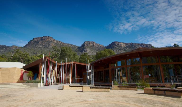
Brambuk The National Park and Cultural Centre
Explore the region
How to get there
The full thirteen days
When you're there
Make Brambuk - The National Park and Cultural Centre in Halls Gap your first stop. Here you can explore what Gariwerd means to Aboriginal people and find information about visiting Grampians National Park.
Safety is your responsibility
- At lookouts, never climb over barriers. Your safety is more important than a social media post.
- There are steep cliffs in the park. Keep to the track, mind your footing and supervise children.
- Many walking tracks involve rock steps, uneven and slippery track surfaces, water crossings and rock hopping.
- Mobile phone service is unavailable in many areas of the park. Seek higher elevations for service.
- Plan your timing, return from walking well before dusk.
Emergency markers
In the event of an emergency, call Triple Zero 000 or 112 to access police and emergency services. Be aware that you may travel out of mobile phone range. Many of our parks feature emergency markers, which are special green signs with a unique code on them so emergency responders can pinpoint your exact location.
Need to know
The full thirteen days
Walking track grades
Hikes along the Grampians Peaks Trail have been graded using the Australian walking track grading system, which is a primary means of informing people about the features of walking tracks, so they can gauge their suitability for a particular track. Under the system, walking trails are graded on a difficulty scale from grades one to five.
Grade 1: No bushwalking experience required. Flat even surface with no steps or steep sections. Suitable for assisted wheelchair users.
Grade 2: No bushwalking experience required. A hardened or compacted surface which may have gentle hill sections or occasional steps.
Grade 3: Suitable for most ages and fitness levels. Tracks may have short steep sections, a rough surface and many steps.
Grade 4: Bushwalking experience recommended. Tracks may be long, rough and very steep. Directional signage may be limited.
Grade 5: Very experienced bushwalkers with specialised skills, including navigation and emergency first aid. Tracks likely to be very rough, very steep and unmarked.
Hiking tips for Grampians Peaks Trail
- An Official Grampians Peaks Trail topographic map (for North/Central/South) available from Brambuk the National Park and Cultural Centre, Halls Gap and other visitor outlets in nearby towns (and compass)
- Waterproof jacket and pants, thermal layers, breathable-fabric layers, beanie, sun hat and sunscreen.
- Hiking boots or shoes with a good tread and support.
- Water and food for all meals and snacks, plus extra for an emergency. Fuel stove for cooking.
- Drinking water treatment equipment for untreated water tanks at campground.
- 3-season tent, 3-season sleeping bag, mat and cord/thin rope to attach your tent to timber tent platforms.
- Lightweight gas or liquid fuel stove, matches/lighter, cooking pot and utensils.
- Head torch with spare batteries. Useful when moving around a campground at night.
- Good quality first aid kit with snake bite bandage.
- Mobile phone with USB cable – you can recharge at campgrounds along the trail. We also recommend taking a Personal Locator Beacon (PLB) for extra safety and a small radio to listen to weather or bushfire updates.
- Toilet paper, trowel and a bag to carry your rubbish.
- Waterproof pack liner to keep everything in your hiking backpack dry.
Be bushfire aware
The warmer months are the perfect time to experience regional Victoria. However, Victoria is one of the most fire-prone areas in the world. During summer in Victoria, the weather can be very hot and dry and the risk of summer lightning storms can increase the chance of bushfires.
Follow these bushfire safety tips to ensure that your experience is safe and enjoyable.
Change of Conditions
Nature being nature, sometimes conditions can change at short notice. It’s a good idea to check this page ahead of your visit for any updates.
-
Grampians (Gariwerd) National Park
Rockclimbing Access Changes - Centurion Walls, Tortoise Wall
Re-discovery of cultural heritage at two designated rock-climbing sites in Grampians (Gariwerd) National Park has resulted in changes to access.Centurion WallsSignificant Aboriginal cultural values were rediscovered at Lower Centurion in late 2025. As a result, a partial closure is now in place, ensuring cultural heritage protection while maintaining modified climbing access for visitors. On-ground signage at the access track clearly delineates where climbing is or isn’t permitted.Visitors are advised:- Access is closed from the
area north of and including Damage Done. These sites include:
Damage Done, Shades of Black, Liberator, Lexicon, Temuujin, Killer Wolf, Devilled Haircut, Compressor route, Anti-Christ Superstar, Pining for the Fiords, Unknown Route 2, Genghis Khan, Project KP2, Project KP, Kublai Khan, Stone Temptress, Psychotic Episode, Trail of the dead, Flood the Zone, Push it Upstairs, Progressive Happy House.
- All climbs south of and
including In Plain Sight remain open. These climbs include; In Plain Sight, Who
Dreams of Cats, Who Dreams of Cats – short, Nowhere to Hide,
Afterworld, Left Hand Black, Centrifugal Force, Centrifugal Force –
Romanes Eunt Domas (linkup), Romanes Eunt Domas, Black Nobility, Sandpit,
Ton Steine Scherben, Winged Corpse, HCP, Massacres and Maniacs, Lunchbox
Legend, and AA New Rope / New route.
- Access to Upper Centurion
remains unchanged and is via the south end near Winged Corpse.
Tortoise WallWe’re currently asking visitors to not access the area known as ‘Tortoise Wall’ to avoid causing potential harm to Aboriginal cultural heritage that was rediscovered in April 2026. A temporary closure is now in place, while Parks Victoria and Gariwerd Traditional Owners determine a longer-term management response. Out of respect for this significant cultural landscape, visitors are requested to not access this area.For further information visit the 'rock climbing in Gariwerd' web page https://www.parks.vic.gov.au/places-to-see/parks/grampians-national-park/rock-climbing-in-gariwerdTemporary closure of a Glenelg River Road section – 25 May to 26 June 2026
The section of Glenelg River Road from the Stony Creek Road intersection to the Boreang Campground turn off will be closed from Monday 25 May 2026 to Friday 26 June 2026 for roadworks.The southern end of the closure can be accessed via Rose Creek Road. Paddy Castle walk and Boreang Campground remain open, as does Glenelg River Road, south of Lodge Road.Mount Victory Road will have an increased amount of heavy trucks and machinery. Drivers are urged to slow down and drive with care, particularly in tight corners.Please refer to the map provided for detour information. For further information please contact Brambuk the National Park and Cultural Centre Phone 8427 2058.
Grampians Peaks Trail – Helicopter Operations - Major Mitchell Plateau - 29.05.2026
Helicopter Air-Lift Operations are scheduled along the Grampians Peaks Trail (GPT) in the Major Mitchell Plateau area (Section C4) on Friday 29 May 2026.Temporary ‘hold in place’ closures of approximately 15 minutes will be activated as track repair materials are placed at sites along the central section of the Grampians Peaks Trail.Signage will be installed at trailheads, and contracted staff will be on ground to assist with the temporary closures. Please follow signage advice and remain clear of closed areas during operations.The operations will only take place under favourable weather conditions.For further information, please visit Brambuk the National Park and Cultural Centre in Halls Gap or call 8427 2258.Grampians (Gariwerd) National Park - Roads Update 29.05.2026
The Grampians (Gariwerd) National Park has roads temporarily closed due to bushfire and flood impacts.Please be aware the movement of visitors in parts of the National Park is restrictedOngoing RoadworksMt Zero RdGrading near Roses Gap Rd intersection, drive with caution.Recent OpeningsMitchell RdRecent ClosureGlenelg River RdThe section of Glenelg River Road from the Stony Creek Road intersection to the Boreang Campground turn off will be closed from Monday 25 May 2026 to Friday 26 June 2026 for roadworks.The southern end of the closure can be accessed via Rose Creek Road. Paddy Castle walk and Boreang Campground remain open, as does Glenelg River Road, south of Lodge Road.Likely increased traffic on Rose Creek Road. Also trucks carting materials near Syphon Road.Upcoming Seasonal Road Closures will be in place from 9 June 2026 to 29 October 2026.Please refer to the attached up-to-date road report below.Attachments: Grampians (Gariwerd) National Park - Road Report -29.05.2026 (236KB)
- Access is closed from the
area north of and including Damage Done. These sites include:
-
Mackenzie Falls Day Visitor Area (Grampians (Gariwerd) National Park)
Mackenzie Falls (Migunang wirab) – Closed for major construction works – 9 February 2026 to midyear 2026
Construction work at Mackenzie Falls in the Grampians (Gariwerd) National Park is underway and the carpark and precinct is closed to visitors.The works at Mackenzie Falls precinct includes the construction of a new viewing platform at the base of the falls, upgrades to the carpark and the Bluff Lookout Walk and other important safety improvements to stabilise rock and improve walking tracks.
The Mackenzie Falls carpark and all walking tracks in the precinct including Broken Falls Walk, Mackenzie Falls Walk to the base (from the carpark) and the Bluff Lookout Walk are all closed. We anticipate that construction work will finish in the second half of the year.The carpark will be a construction site throughout the works period with large machinery operating and materials being stored on site. There will be no access for all vehicles or visitors at Mackenzie Falls Precinct during construction.Zumsteins Picnic Area ParkingDuring construction parking at the popular Zumsteins picnic area will be limited. It is not recommended for large passenger coaches and long caravans to visit during construction. Similarly, they should not travel between Mackenzie Falls and Zumsteins due to the narrow winding road.A small amount of parking for campervans, small motorhomes and cars with trailers is available opposite the Zumsteins Picnic Area car park, however, may not be available on busy weekends and public holidays.Zumsteins to Fish Falls – This popular walk to the beautiful Fish Falls is a 1.5 to 2 hour return walk (Grade 3) – walkers should have a reasonable fitness level, carry water and wear sturdy walking shoes as the track can be rocky with uneven surfaces and some steep sections.Mackenzie River Walk – There will be no access to the base of Mackenzie Falls from Zumsteins Picnic Area from 27 April 2026 until construction works are complete. Fish Falls will still be accessible from Zumsteins Picnic Area.For further information on the Mackenzie Falls (Migunang wirab) project visit https://www.parks.vic.gov.au/projects/western-victoria/mackenzie-falls-revitalisationPopular day visitor sites such as Reeds Lookout, the Balconies, Boroka Lookout, Silverband Falls and various walks with large bus carparking will still be available.For further information contact Brambuk the National Park and Cultural Centre in Halls Gap (Ph 8427 2058).Please keep up to date with closures through the Change of Conditions page for Grampians (Gariwerd) National Park. -
Billimina Walk (Grampians (Gariwerd) National Park)
Billimina Walk – Temporary closure
Billimina Walk and Rock Art Shelter remain closed to visitors due to track damage from the 2024/25 summer bushfires.An alternative walk in this area is the Manja Walk to the Manja Shelter, which is an Aboriginal Rock Art site in the Victoria Range.For more information visit Brambuk the National Park and Cultural Centre in Halls Gap or call 03 8427 2058. -
The Fortress Walk (Victoria Range Remote and Natural Area, Grampians (Gariwerd) National Park)
The Fortress Walk and Hike-in Campground – Temporary closure
The Fortress Walk and The Fortress Hike-in Camp remain closed to visitors due to track damage from the 2024/25 summer bushfires.For more information on alternate walks in the western section of the Grampians (Gariwerd) National Park visit Brambuk the National Park and Cultural Centre in Halls Gap or call 03 8427 2058. -
The Chimney Pots Walk (Grampians (Gariwerd) National Park, Victoria Range Remote and Natural Area)
The Chimney Pots Walk – Temporary closure
The Chimney Pots Walk remains closed to visitors due to track damage from the 2024/25 summer bushfires.For more information on alternate walks in the western section of the Grampians (Gariwerd) National Park visit Brambuk the National Park and Cultural Centre in Halls Gap or call 03 8427 2058. -
Red Gum Walk (Grampians (Gariwerd) National Park)
Red Gum Walk – Temporary closure
The Red Gum Walk remains closed to visitors due to track damage from the 2024/25 summer bushfires.For more information on alternate walks in the western section of the Grampians (Gariwerd) National Park visit Brambuk the National Park and Cultural Centre in Halls Gap or call 03 8427 2058. -
Mafeking Picnic Area (Grampians (Gariwerd) National Park)
Mafeking Picnic Ground and Brownings Loop Walk – Temporary closure
Mafeking Picnic Area and Brownings Loop Walk remain closed to visitors due to damage from the 2024/25 summer bushfires.For more information visit Brambuk the National Park and Cultural Centre in Halls Gap or call 03 8427 2058. -
Strachans Campground (Grampians (Gariwerd) National Park)
Strachans Campground –Temporary Closure – 13 April – 25 June 2026
Strachans Campground will be closed to visitors for major upgrade works from 13 April to 25 June 2026.Alternative campgrounds can be booked at https://bookings.parks.vic.gov.au/bookFor further information contact Brambuk the National Park and Cultural Centre in Halls Gap (Ph 8427 2058). -
Brambuk the National Park and Cultural Centre (Grampians (Gariwerd) National Park, Brambuk - The National Park and Cultural Centre Park)
Brambuk the National Park and Cultural Centre – Building Upgrades in 2026
The Cultural Centre is closed for refurbishment.Parks Victoria is working with a strategic partnership committee of Gariwerd Traditional Owners from Barengi Gadjin Land Council, Eastern Maar Aboriginal Corporation, and Gunditj Mirring Traditional Owners Aboriginal Corporation to ‘reimagine’ the future of Brambuk the National Park and Cultural Centre.Building upgrades are essential to ensure the centre meets current services requirements, accessibility, and compliance to current building regulation. New visitor experiences and activation opportunities including Aboriginal arts, community events and cultural exhibitions are being explored as Brambuk moves towards operation by a Gariwerd Traditional Owner entity.The National Park Information Centre and gift shop remain open.For up-to-date national park information, brochures, maps, permits and access advice contact information staff at Brambuk the National Park and Cultural Centre info@parks.vic.gov.au or phone 8427 2058For Junior Ranger School holiday programs visit https://www.parks.vic.gov.au/things-to-do/junior-rangersFor a list of Grampians (Gariwerd) National Park Licensed Tour Operators Visit https://www.parks.vic.gov.au/ltoFurther details on the Brambuk Reimagining project can be found on the Parks Victoria website https://www.parks.vic.gov.au/projects/western-victoria/brambuk-cultural-centre-upgrade -
Notices Affecting Multiple Parks
Pest Animal Control Program Scheduled in Grampians (Gariwerd) National Park and Black Range State Park (Burrunj)
Throughout June, a ground shooting program (involving firearms) will occur throughout Grampians (Gariwerd) National Park and Black Range State Park- Grampians (Gariwerd) National Park: Every
week of June
- Black Range State Park (Burrunj): 22nd June and
25 June
The program will be delivered at night between 6pm to 5am, in remote areas away from busy visitor sites, and will be carried out by professionals under strict conditions to ensure practices are safe, effective, and humane.There will be no visitor site closures as part of this operation. Areas will be thoroughly assessed and swept prior, but there may be signage in place to notify visitors of the operation occurring in the surrounding area.Target species include deer and goats which cause serious damage to native plants, animals, and habitat by trampling and destroying plants, increasing grazing pressure, ring-barking young trees, fouling waterholes, causing soil erosion, and spreading weeds. Introduced predators (foxes and cats) prey on small mammals and reptiles and impact the ability of these species to recover from bushfire events.For further information, please contact Brambuk the National Park and Cultural Centre at brambuk@parks.vic.gov.au - Grampians (Gariwerd) National Park: Every
week of June
Similar Trails
Great Ocean Walk
Falls to Hotham Alpine Crossing