
Grampians National Park is part of the Gariwerd Aboriginal cultural landscape. Parks Victoria respects the deep and continuing connection that Traditional Owners have to these lands and waters, and we recognise their ongoing role in caring for Country.
![]()
![]()
![]()
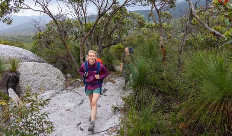
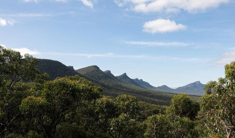
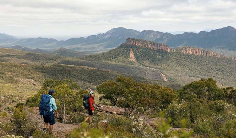
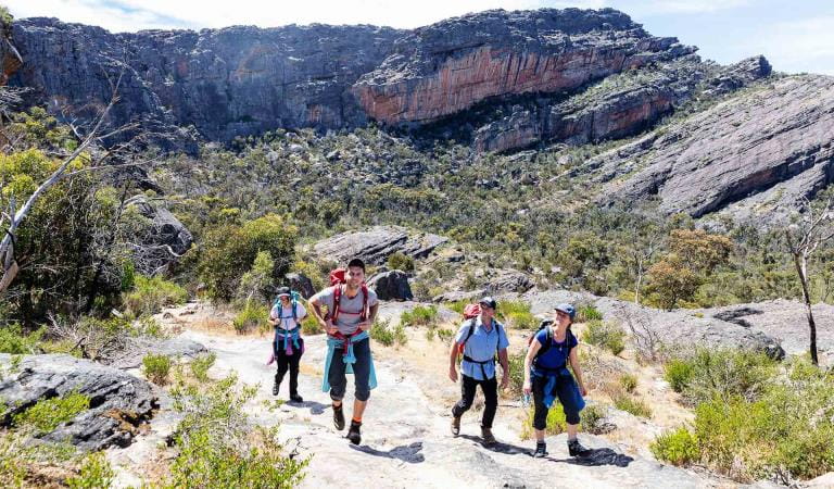
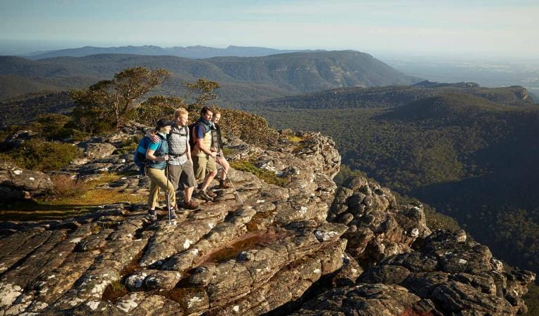
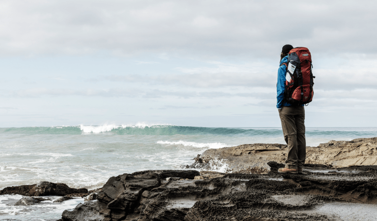
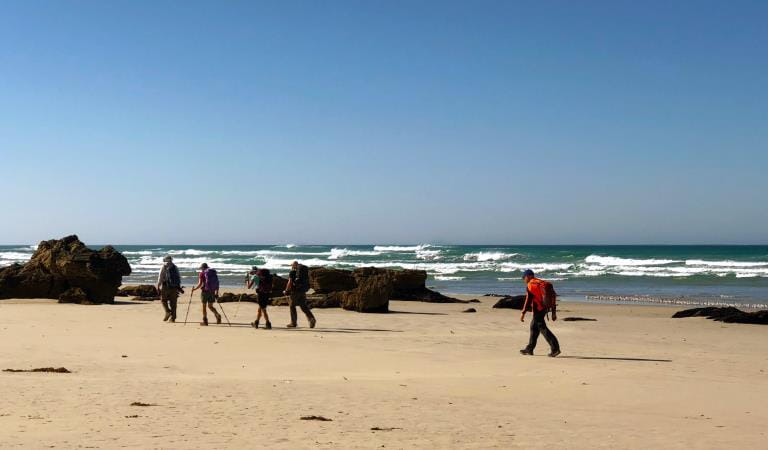
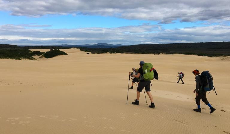
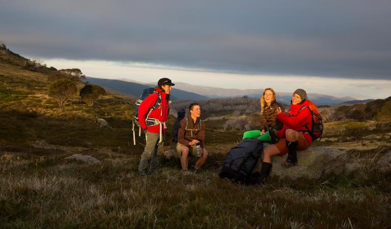
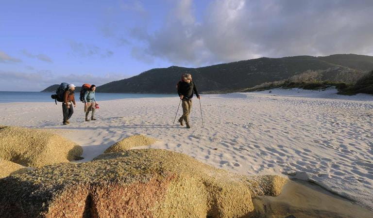
For people who enjoy an outdoor adventure but don’t have time to do the full 13-day Grampians Peaks Trail, breaking it up into smaller 3-day hikes is a great way to challenge yourself, build-up long distance hiking skills and experience the spectacular living cultural landscape of Gariwerd. Return again at your leisure to complete more sections of the trail.
You can also start with a suggested 3-day hike and add additional days of hiking using the GPT interactive map to create your preferred hiking adventure. Below are suggested 3-day hikes arranged in order from north to south.
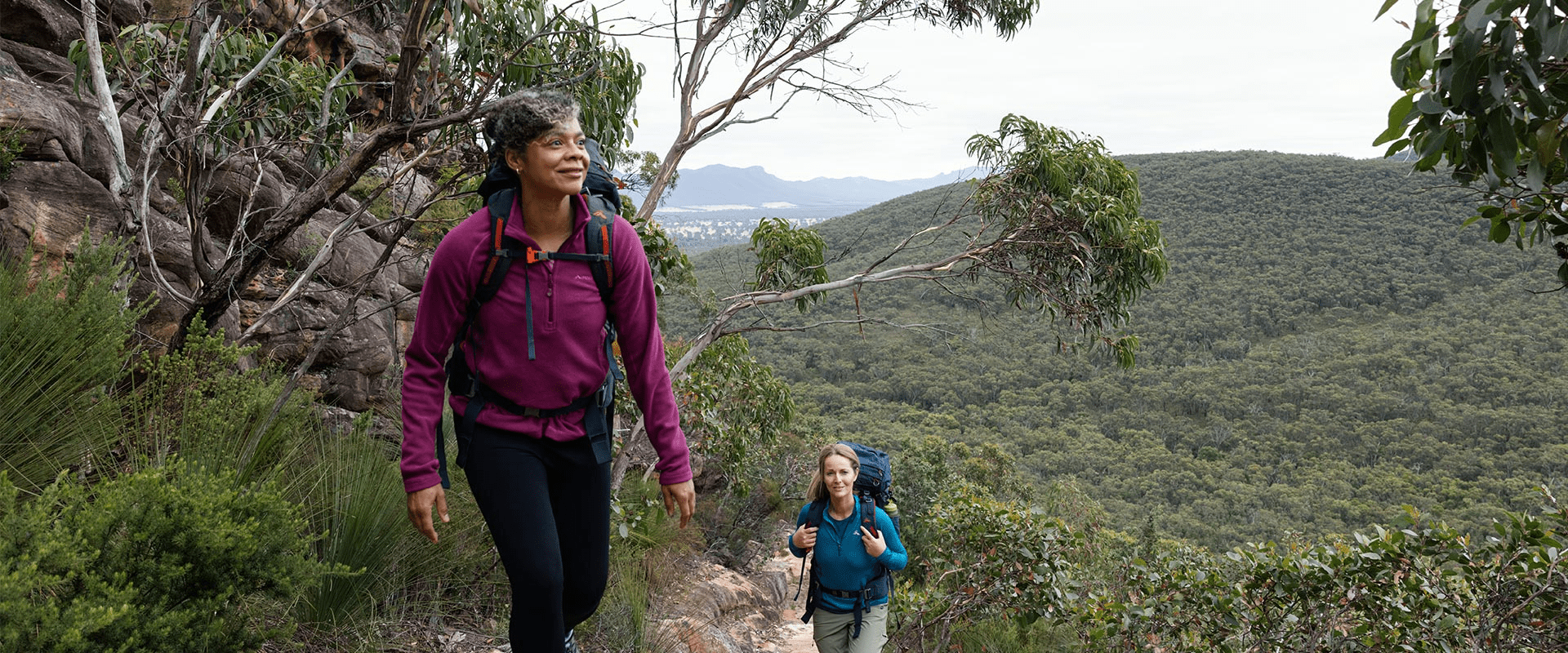
The Grampians Peaks trail is best completed in a north-to-south direction. This allows you to experience the most dramatic views on your hike as they reveal in the landscape. However, it can also be booked in south-to-north direction by using the GPT interactive map.
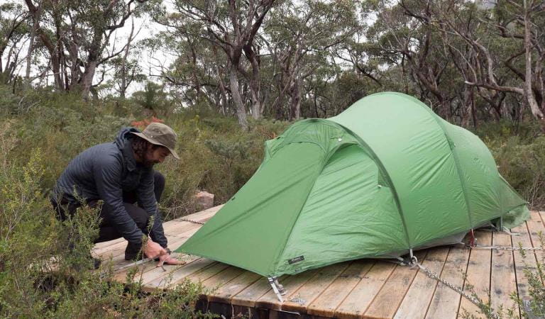
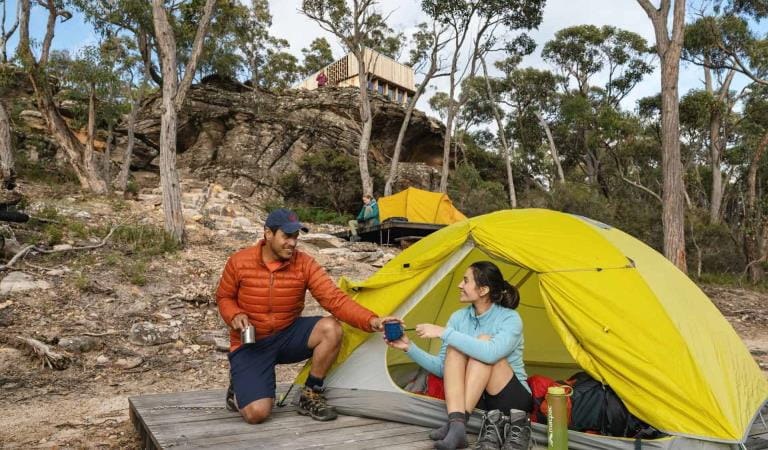
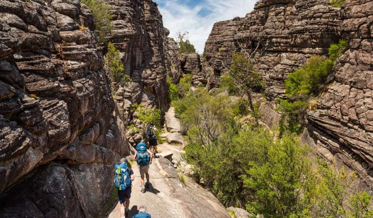
The Grampians Peaks Trail is free for anyone to walk on it, no charge. The 11 hike-in campgrounds have a fee, as do all bookable campgrounds in parks. These hike-in campgrounds are in very remote locations, you're not near a busy road or carpark, so you feel the reward of being deep inside the national park. They have been built with a good level of amenity that is well designed, sympathetic to the landscape and sustainable. As such, they are priced higher for the value they provide. The price for a tent pad for a 3-day/2-night hike is $100.80 ($50.40 p/person for two people sharing). That's roughly $50 per night ($25 p/person if sharing) in camping fees for these unique, well-equipped hike-in campgrounds. These fees contribute towards the operation and maintenance of this unique hiking experience and helps to protect the enviornmental values of this heritage-listed national park.
Water safety
For your safety, having enough water along the Grampians Peaks Trail for hydration and cooking is so important. Our water information and availability page includes the locations (with latitude and longitude references) of serviced water tanks. All water tanks along the trail are untreated. So you need a safe way to treat water for drinking.
Plan and prepare
When planning this incredible hike, read the Grampians Peaks Trail Plan and Prepare Guide and order the official topographical maps from Brambuk the National Park and Cultural Centre in Halls Gap. And when the time comes, before you set-off, visit Brambuk and speak to knowledgeable staff for the latest park information.
Choose your preferred 3-day hiking itinerary
Gar and Werdug 3-day Hike
Bugiga and Barri Yalug 3-day Hike
Duwul and Durd Durd 3-day Hike
Yarram and Wannon 3-day Hike
Djardji-djawara and Mud-dadjug 3-day Hike
Grampians Peaks Trail Experiences
Grampians Peaks Trail
Day walks
Overnight Hikes
Full Grampians Peaks Trail (north to south)
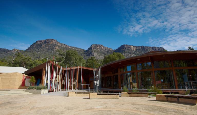
Brambuk The National Park and Cultural Centre
When you're there
Make Brambuk - The National Park and Cultural Centre in Halls Gap your first stop. Here you can explore what Gariwerd means to Aboriginal people and find information about visiting Grampians National Park.
Safety is your responsibility
- At lookouts, never climb over barriers. Your safety is more important than a social media post.
- There are steep cliffs in the park. Keep to the track, mind your footing and supervise children.
- Many walking tracks involve rock steps, uneven and slippery track surfaces, water crossings and rock hopping.
- Mobile phone service is unavailable in many areas of the park. Seek higher elevations for service.
- Plan your timing, return from walking well before dusk.
Emergency markers
In the event of an emergency, call Triple Zero 000 or 112 to access police and emergency services. Be aware that you may travel out of mobile phone range. Many of our parks feature emergency markers, which are special green signs with a unique code on them so emergency responders can pinpoint your exact location.
Need to know
3-day hikes
Walking track grades
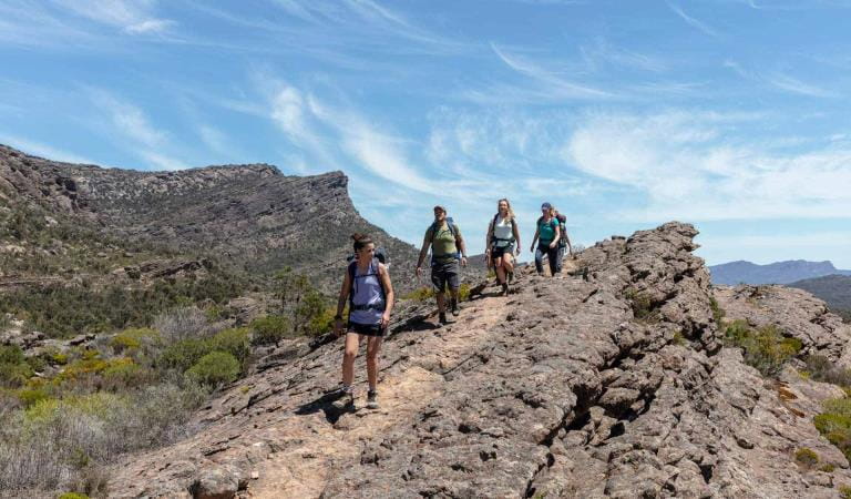
Hikes along the Grampians Peaks Trail have been graded using the Australian walking track grading system, which is a primary means of informing people about the features of walking tracks, so they can gauge their suitability for a particular track. Under the system, walking trails are graded on a difficulty scale from grades one to five.
Grade 1: No bushwalking experience required. Flat even surface with no steps or steep sections. Suitable for assisted wheelchair users.
Grade 2: No bushwalking experience required. A hardened or compacted surface which may have gentle hill sections or occasional steps.
Grade 3: Suitable for most ages and fitness levels. Tracks may have short steep sections, a rough surface and many steps.
Grade 4: Bushwalking experience recommended. Tracks may be long, rough and very steep. Directional signage may be limited.
Grade 5: Very experienced bushwalkers with specialised skills, including navigation and emergency first aid. Tracks likely to be very rough, very steep and unmarked.
Be bushfire aware
The warmer months are the perfect time to experience regional Victoria. However, Victoria is one of the most fire-prone areas in the world. During summer in Victoria, the weather can be very hot and dry and the risk of summer lightning storms can increase the chance of bushfires.
Follow these bushfire safety tips to ensure that your experience is safe and enjoyable.
Change of Conditions
Nature being nature, sometimes conditions can change at short notice. It’s a good idea to check this page ahead of your visit for any updates.
-
The Fortress Walk (Grampians (Gariwerd) National Park, Victoria Range Remote and Natural Area)
The Fortress Walk and Hike-in Campground – Temporary closure
The Fortress Walk and The Fortress Hike-in Camp remain closed to visitors due to track damage from the 2024/25 summer bushfires.For more information on alternate walks in the western section of the Grampians (Gariwerd) National Park visit Brambuk the National Park and Cultural Centre in Halls Gap or call 03 8427 2058. -
The Chimney Pots Walk (Grampians (Gariwerd) National Park, Victoria Range Remote and Natural Area)
The Chimney Pots Walk – Temporary closure
The Chimney Pots Walk remains closed to visitors due to track damage from the 2024/25 summer bushfires.For more information on alternate walks in the western section of the Grampians (Gariwerd) National Park visit Brambuk the National Park and Cultural Centre in Halls Gap or call 03 8427 2058. -
Red Gum Walk (Grampians (Gariwerd) National Park)
Red Gum Walk – Temporary closure
The Red Gum Walk remains closed to visitors due to track damage from the 2024/25 summer bushfires.For more information on alternate walks in the western section of the Grampians (Gariwerd) National Park visit Brambuk the National Park and Cultural Centre in Halls Gap or call 03 8427 2058. -
Strachans Campground (Grampians (Gariwerd) National Park)
Strachans Campground –Temporary Closure – 13 April – 30 July 2026
Strachans Campground will be closed to visitors between 13 April and 30 July 2026 while major upgrade works are completed.For further information contact Brambuk the National Park and Cultural Centre in Halls Gap (Ph 8427 2058). -
Mackenzie Falls Day Visitor Area (Grampians (Gariwerd) National Park)
Mackenzie Falls (Migunang wirab) - Upcoming closure for major construction works – 9 February 2026 to the end of 2026
This update is to provide information for the planned construction work at Mackenzie Falls in the Grampians (Gariwerd) National Park, and closures while the works happen.The works at Mackenzie Falls precinct includes the construction of a new viewing platform at the base of the falls, upgrades to the carpark and the Bluff Lookout Walk and other important safety improvements to stabilise rock and improve walking tracks.
The Mackenzie Falls carpark and all walking tracks in the precinct including Broken Falls Walk, Mackenzie Falls Walk to the base (from the carpark), the Bluff Lookout Walk, and parts of Mackenzie Falls River Walk will close when construction starts on Monday, 9 February, 2026, and we anticipate that construction work will finish by the end of 2026.The carpark will be a construction site throughout the works period with large machinery operating and materials being stored on site. There will be no access for all vehicles or visitors at Mackenzie Falls Precinct during construction.Zumsteins Picnic AreaWhen construction works start at Mackenzie Falls precinct, parking at the popular Zumstein picnic area will be limited, especially for large vehicles (buses and caravans) during weekends and holiday periods.Zumsteins to Fish Falls – This popular walk to the beautiful Fish Falls is a 1.5 to 2 hour return walk (Grade 3) – walkers should have a reasonable fitness level, carry water and wear sturdy walking shoes as the track can be rocky with uneven surfaces and some steep sections.Mackenzie River WalkFrom May 2026 until works are complete, the base of Mackenzie Falls will not be accessible via the Mackenzie River Walk from Zumsteins Picnic Area.
For further information on the Mackenzie Falls (Migunang wirab) project visit https://www.parks.vic.gov.au/projects/western-victoria/mackenzie-falls-revitalisation
Popular day visitor sites such as Reeds Lookout, the Balconies, Boroka Lookout, Silverband Falls and various walks with large bus carparking will still be available. For further information on the Mackenzie Falls River Walk contact Brambuk the National Park and Cultural Centre in Halls Gap (Ph 8427 2058).Please keep up to date with closures through the Change of Conditions page for Grampians (Gariwerd) National Park. -
Grampians (Gariwerd) National Park
Temporary closure of a Glenelg River Road section – 25 May to 17 July 2026
The section of Glenelg River Road from the Stony Creek Road intersection to the Boreang Campground turn off will be closed from Monday 25 May 2026 to Friday 17 July 2026 for roadworks.The southern end of the closure can be accessed via Rose Creek Road. Paddy Castle Walk and Boreang Campground remain open, as does Glenelg River Road, south of Lodge Road.Mount Victory Road will have an increased amount of heavy trucks and machinery. Drivers are urged to slow down and drive with care, particularly in tight corners.For further information please contact Brambuk the National Park and Cultural Centre Phone 8427 2058.Grampians (Gariwerd) National Park - Roads Update 10.07.2026
The Grampians (Gariwerd) National Park has roads temporarily closed due to bushfire and weather impacts.Please observe road closures, traffic hazard signage and always drive to conditions.Seasonal Road Closures are now in place from the 9 June 2026 to 29 October 2026.Please refer to the attached up-to-date road report below.Attachments: Grampians (Gariwerd) National Park - Road Report 10.07.2026 (230KB)
-
Brambuk the National Park and Cultural Centre (Brambuk - The National Park and Cultural Centre Park, Grampians (Gariwerd) National Park)
Brambuk the National Park and Cultural Centre – Building Upgrades in 2026
The Cultural Centre is closed for refurbishment.Parks Victoria is working with a strategic partnership committee of Gariwerd Traditional Owners from Barengi Gadjin Land Council, Eastern Maar Aboriginal Corporation, and Gunditj Mirring Traditional Owners Aboriginal Corporation to ‘reimagine’ the future of Brambuk the National Park and Cultural Centre.Building upgrades are essential to ensure the centre meets current services requirements, accessibility, and compliance to current building regulation. New visitor experiences and activation opportunities including Aboriginal arts, community events and cultural exhibitions are being explored as Brambuk moves towards operation by a Gariwerd Traditional Owner entity.The National Park Information Centre and gift shop remain open.For up-to-date national park information, brochures, maps, permits and access advice contact information staff at Brambuk the National Park and Cultural Centre info@parks.vic.gov.au or phone 8427 2058For Junior Ranger School holiday programs visit https://www.parks.vic.gov.au/things-to-do/junior-rangersFor a list of Grampians (Gariwerd) National Park Licensed Tour Operators Visit https://www.parks.vic.gov.au/ltoFurther details on the Brambuk Reimagining project can be found on the Parks Victoria website https://www.parks.vic.gov.au/projects/western-victoria/brambuk-cultural-centre-upgrade
Similar experiences at other parks
Hike for 1–3 nights
Great South West Walk
Wilderness Coast Walk
Falls to Hotham Alpine Crossing
Wilsons Promontory Northern Overnight Hikes