
Grampians National Park is part of the Gariwerd Aboriginal cultural landscape. Parks Victoria respects the deep and continuing connection that Traditional Owners have to these lands and waters, and we recognise their ongoing role in caring for Country.
![]()
![]()
![]()
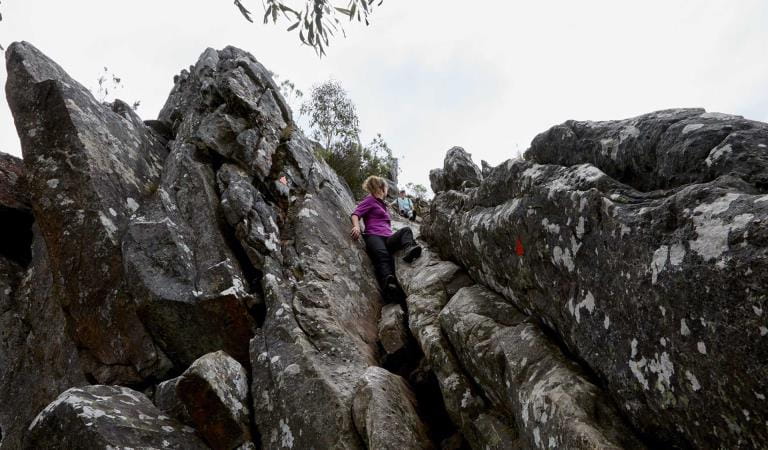
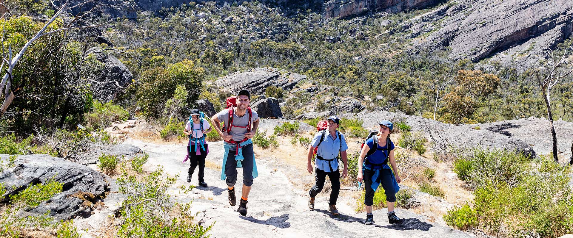
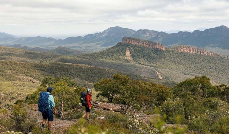
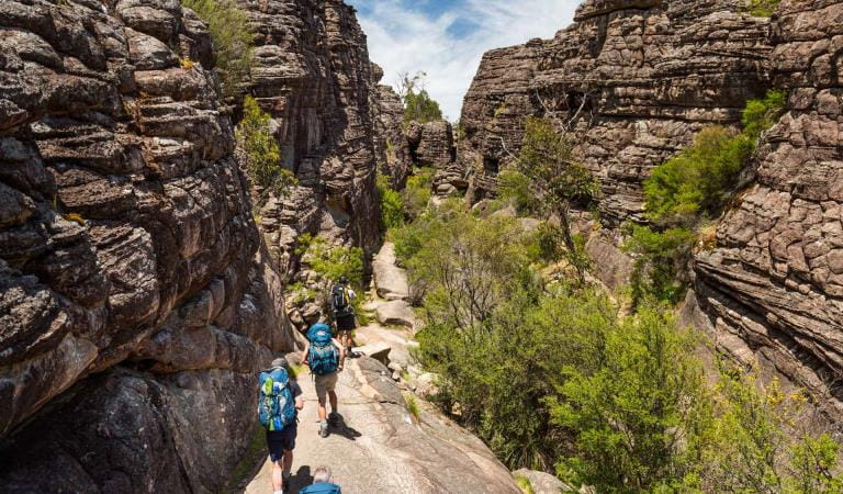
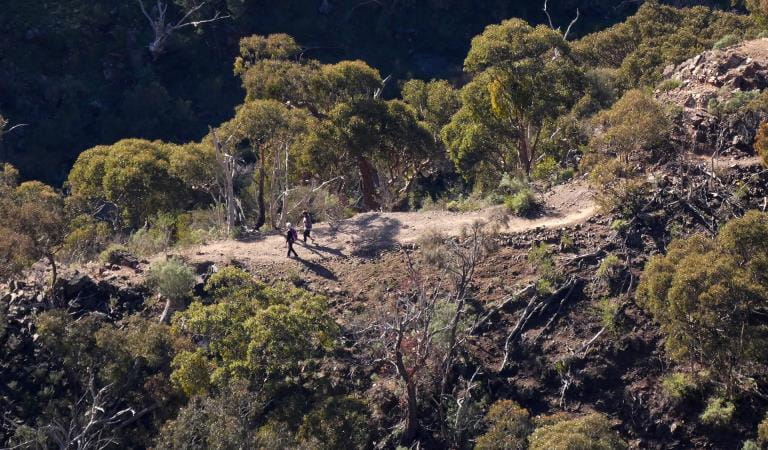
Get a sample of the Grampians Peaks Trail with one of our suggested day walks. Explore the ancient, rugged landscape of Gariwerd and discover the natural beauty of the Grampians National Park.
Water safety
For your safety, having enough water along the Grampians Peaks Trail for hydration and cooking is so important. Our water information and availability page includes the locations (with latitude and longitude references) of serviced water tanks. All water tanks along the trail are untreated. So you need a safe way to treat water for drinking.
Mt Stapylton Loop
Mt Zero Picnic Area or alternatively from Stapylton Campground
Loop: 9.7km, 4 - 5hrs
Grade 4 (Hard): Challenging steep sections, rock hopping, slippery surfaces and exposed rocky outcrops.
Start: Mt Zero Picnic Area, Mt Zero Road.
Follow Grampians Peaks Trail markers for 500m up ‘Flat Rock’ to an outcrop overlooking the Stapylton Amphitheatre and the spectacular orange-coloured Taipan Wall. Continue downhill to the next track junction where the Loop walk begins. You will return to this point later.
Keep left and continue 1.3km before beginning to climb steadily up and over rocky terraces, passing ‘bird rock’.
At the Mt Stapylton summit intersection take the 600m return walk to the lower area before continuing south along the Grampians Peaks Trail. The track winds its way up, over and under rocky outcrops for the next 2.3km.
At the next track junction follow signs leaving the Grampians Peaks Trail and head west, downhill towards Pohlners Road and the Stapylton Campground track junction where the track heads north-west for 3km leading back into the Stapylton Amphitheatre and back on to the Grampians Peaks Trail.
This concludes the loop and you return to Mt Zero Picnic Area via Flat Rock.
Lower Waterfalls of Gar (Mt Difficult)
Troopers Creek Campground Return walk: 4.2km. 2 hours
Grade 3 (Medium): Steep sections. Steep rock steps and walking track, creek crossings, slippery rocks, and exposed cliff edges. Note: the walking track beyond the falls and on to Gar (Mt Difficult) and Briggs Bluff is Grade 4: Hard. For fit, experienced and prepared walkers only.
Start: From Troopers Creek Campground. A series of seasonal waterfalls that are best seen after rain. Spectacular views from rocky lookouts.
Follow the creek side track steadily uphill for 1.8km past the first small waterfall spilling from a wave-shaped rock. Continue on upwards enjoying fine views to finish at the base of the third waterfall. Return via the same route.
Lake Wartook Lookout
Mt Difficult Road Return walk: 1.1km, 40 minutes
Grade 3 (Medium): Uneven surfaces, slippery rocks, exposed cliff edges.
Start: Lake Wartook Lookout, Mt Difficult Road. Approximately 4.5km north of Boroka Lookout carpark.
From the roadside you will walk west before climbing steadily up rock staircases and over rocky terraces to finally climb through a narrow rocky slot onto the summit. Return via the same route.
Lake Wartook Lookout to Halls Gap
Mt Difficult Road
One-way: 10.9km, 3-4 hours
Vehicle drop/shuffle required or 20.7km return, 6-7 hours
Grade 4 (Hard): Challenging steep sections, rock hopping, slippery surfaces and exposed rocky outcrops.
Start: Lake Wartook Lookout, Mt Difficult Road. Note: unsealed road access to the lookout car park requires higher clearance vehicles. Limited parking available.
From Lake Wartook Lookout follow the Grampians Peaks Trail south for 1.1km to cross the Mt Difficult Road and for 2km walk through low forest before taking steep descending steps into taller forest. It is a gradual downhill walk south via the Chatauqua Peak saddle, Clematiss Falls and the Botanic Gardens into Halls Gap.
Signal Peak
Mt Abrupt Carpark
Return walk: 7.8km, 3 - 4 hours
Grade 4 (Hard): Challenging steep sections, rock hopping, slippery surfaces and exposed rocky outcrops.
Start: Mt Abrupt Carpark. Cross the Grampians Tourist Road and follow the signs to Mt Abrupt and Signal Peak. The track steadily rises through low forest, crossing several landslides that occurred in 2011.
Turn right after 1.7km at the track junction. Signal Peak is 2.2km from here. Follow the track for 2.2km as it winds below a rocky escarpment and through a saddle with tall trees. From the saddle the track climbs up onto the drier western slopes of Signal Peak passing through heathy vegetation before finally reaching the summit at an elevation of 780m.
More Grampians Peaks Trail experiences
Grampians Peaks Trail
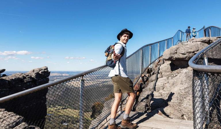
The Pinnacle walks
Overnight Hikes
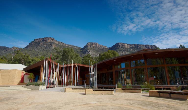
Brambuk The National Park and Cultural Centre
Grampians Peaks Trail Day Walks
This area is well known for its wildlife. Keep an eye out for:
How to get there
Day walks
The Grampians Peaks Trail currently starts and finishes in Halls Gap, which is a good starting point for anyone looking to walk or hike any of the trails in the Grampians National Park. The 260 km drive to Halls Gap from Melbourne along the Western or Glenelg Highways takes about 3 hours. There are approaches to Halls Gap via Stawell, Ararat or Dunkeld.
When you're there
Local Visitor Information Centres can assist with accommodation, walk, dining, tours, activities, festivals, events and Licensed Tour Operators.
Go to www.visitgrampians.com.au to explore the many possibilities available.
Grampians Peaks Trail Day Walks fact sheet
Download the Grampians Peaks Trail Day Walks fact sheet to find out more information about the walks and maps.
Bushwalking tips
A range of detailed walking guides including maps are available from Brambuk The National Park and Cultural Centre, Halls Gap and other visitor outlets in nearby towns.
Here are a few planning tips to keep you safe and prepared:
- Plan your walk to match the weather, your fitness, hiking skills and experience.
- Take a backpack with maps, food, water, protective clothing, first aid and navigation gear.
- Wear boots or shoes with strong grip, wear layered clothing suited to the weather.
- Strong winds, low temperatures and heavy rain/squalls can occur any time of year.
- In Winter temperatures can be below 0°C. Navigation is difficult in white-out conditions.
- In Summer and Autumn temperatures are often above 40°C. Have a personal bushfire plan.
- Keep an eye on track markers. Stop and seek shelter if you are unsure of your location.
- If walking alone or in remote areas, ensure you have your own emergency contact in place.
- Ensure your contacts know your start, finish times and locations.
- Always leave early in the morning and plan to return before dark.
- Walking tracks may involve rock steps, uneven and slippery track surfaces, water crossings and rock hopping.
- There are steep cliffs throughout the Grampians, please stay on clearly marked trails, avoid clifftop selfies, and supervise children at all times.
Caring for the national park
- There are no rubbish bins - reduce your use of disposable items and take all of your rubbish home with you.
- Dogs and domestic pets are not permitted anywhere in the Grampians National Park, including in your car.
Be fire ready
Ensure you have a personal fire plan. Source a copy of the Fire Danger Information Sheet. Available from Brambuk the National Park and Cultural Centre and local Visitor Information Centres.
For emergency updates and fire information call 1800 226 226, listen to local radio (94.1FM, 89.3FM, 91.7FM or 594AM), download the VicEmergency phone app or visit emergency.vic.gov.au
The Grampians National Park overlaps the Wimmera and South West fire districts.
Need to know
Day walks
Accessibility
Visiting a park can be more of a challenge for people with disabilities, however in Victoria there are a wide range of facilities to help people of all abilities enjoy our wonderful parks around the state.
Although the walks on this page are not suitable, a TrailRider all-terrain wheelchair and volunteers are now available for park visitors with limited mobility to explore the natural beauty of other parts of the Grampians National Park. The Grampians has two TrailRiders available for visitors and both of these chairs are fitted with electric motors to assist operators on steeper sections of track. Passengers must wear a helmet.
The TrailRider all-terrain wheelchair and Volunteer service is free of charge, however, please book a week in advance. To book the TrailRider please contact the Volunteer Coordinator on (03) 8427 3541 or volunteer@parks.vic.gov.au
Assistance dogs are welcome in Parks Victoria parks and reserves. Entry requirements apply for parks and reserves that are usually dog prohibited, such as national parks.
Subscribe to Parks Victoria
Sign up to receive the latest ideas, inspiration and news delivered right to your inbox.
Change of Conditions
Nature being nature, sometimes conditions can change at short notice. It’s a good idea to check this page ahead of your visit for any updates.
-
The Fortress Walk (Victoria Range Remote and Natural Area, Grampians (Gariwerd) National Park)
The Fortress Walk and Hike-in Campground – Temporary closure
The Fortress Walk and The Fortress Hike-in Camp remain closed to visitors due to track damage from the 2024/25 summer bushfires.For more information on alternate walks in the western section of the Grampians (Gariwerd) National Park visit Brambuk the National Park and Cultural Centre in Halls Gap or call 03 8427 2058. -
The Chimney Pots Walk (Victoria Range Remote and Natural Area, Grampians (Gariwerd) National Park)
The Chimney Pots Walk – Temporary closure
The Chimney Pots Walk remains closed to visitors due to track damage from the 2024/25 summer bushfires.For more information on alternate walks in the western section of the Grampians (Gariwerd) National Park visit Brambuk the National Park and Cultural Centre in Halls Gap or call 03 8427 2058. -
Red Gum Walk (Grampians (Gariwerd) National Park)
Red Gum Walk – Temporary closure
The Red Gum Walk remains closed to visitors due to track damage from the 2024/25 summer bushfires.For more information on alternate walks in the western section of the Grampians (Gariwerd) National Park visit Brambuk the National Park and Cultural Centre in Halls Gap or call 03 8427 2058. -
Strachans Campground (Grampians (Gariwerd) National Park)
Strachans Campground –Temporary Closure – 13 April – 30 July 2026
Strachans Campground will be closed to visitors between 13 April and 30 July 2026 while major upgrade works are completed.For further information contact Brambuk the National Park and Cultural Centre in Halls Gap (Ph 8427 2058). -
Mackenzie Falls Day Visitor Area (Grampians (Gariwerd) National Park)
Mackenzie Falls (Migunang wirab) - Upcoming closure for major construction works – 9 February 2026 to the end of 2026
This update is to provide information for the planned construction work at Mackenzie Falls in the Grampians (Gariwerd) National Park, and closures while the works happen.The works at Mackenzie Falls precinct includes the construction of a new viewing platform at the base of the falls, upgrades to the carpark and the Bluff Lookout Walk and other important safety improvements to stabilise rock and improve walking tracks.
The Mackenzie Falls carpark and all walking tracks in the precinct including Broken Falls Walk, Mackenzie Falls Walk to the base (from the carpark), the Bluff Lookout Walk, and parts of Mackenzie Falls River Walk will close when construction starts on Monday, 9 February, 2026, and we anticipate that construction work will finish by the end of 2026.The carpark will be a construction site throughout the works period with large machinery operating and materials being stored on site. There will be no access for all vehicles or visitors at Mackenzie Falls Precinct during construction.Zumsteins Picnic AreaWhen construction works start at Mackenzie Falls precinct, parking at the popular Zumstein picnic area will be limited, especially for large vehicles (buses and caravans) during weekends and holiday periods.Zumsteins to Fish Falls – This popular walk to the beautiful Fish Falls is a 1.5 to 2 hour return walk (Grade 3) – walkers should have a reasonable fitness level, carry water and wear sturdy walking shoes as the track can be rocky with uneven surfaces and some steep sections.Mackenzie River WalkFrom May 2026 until works are complete, the base of Mackenzie Falls will not be accessible via the Mackenzie River Walk from Zumsteins Picnic Area.
For further information on the Mackenzie Falls (Migunang wirab) project visit https://www.parks.vic.gov.au/projects/western-victoria/mackenzie-falls-revitalisation
Popular day visitor sites such as Reeds Lookout, the Balconies, Boroka Lookout, Silverband Falls and various walks with large bus carparking will still be available. For further information on the Mackenzie Falls River Walk contact Brambuk the National Park and Cultural Centre in Halls Gap (Ph 8427 2058).Please keep up to date with closures through the Change of Conditions page for Grampians (Gariwerd) National Park. -
Grampians (Gariwerd) National Park
Temporary closure of a Glenelg River Road section – 25 May to 17 July 2026
The section of Glenelg River Road from the Stony Creek Road intersection to the Boreang Campground turn off will be closed from Monday 25 May 2026 to Friday 17 July 2026 for roadworks.The southern end of the closure can be accessed via Rose Creek Road. Paddy Castle Walk and Boreang Campground remain open, as does Glenelg River Road, south of Lodge Road.Mount Victory Road will have an increased amount of heavy trucks and machinery. Drivers are urged to slow down and drive with care, particularly in tight corners.For further information please contact Brambuk the National Park and Cultural Centre Phone 8427 2058.Grampians (Gariwerd) National Park - Roads Update 03.07.2026
The Grampians (Gariwerd) National Park has roads temporarily closed due to bushfire and weather impacts.Please observe road closures, warning signs and always drive to conditions.Seasonal Road Closures are now in place from the 9 June 2026 to 29 October 2026.Please refer to the attached up-to-date road report.Attachments: Grampians (Gariwerd) National Park - Road Report 03.07.2026 (1) (230KB)
-
Brambuk the National Park and Cultural Centre (Brambuk - The National Park and Cultural Centre Park, Grampians (Gariwerd) National Park)
Brambuk the National Park and Cultural Centre – Building Upgrades in 2026
The Cultural Centre is closed for refurbishment.Parks Victoria is working with a strategic partnership committee of Gariwerd Traditional Owners from Barengi Gadjin Land Council, Eastern Maar Aboriginal Corporation, and Gunditj Mirring Traditional Owners Aboriginal Corporation to ‘reimagine’ the future of Brambuk the National Park and Cultural Centre.Building upgrades are essential to ensure the centre meets current services requirements, accessibility, and compliance to current building regulation. New visitor experiences and activation opportunities including Aboriginal arts, community events and cultural exhibitions are being explored as Brambuk moves towards operation by a Gariwerd Traditional Owner entity.The National Park Information Centre and gift shop remain open.For up-to-date national park information, brochures, maps, permits and access advice contact information staff at Brambuk the National Park and Cultural Centre info@parks.vic.gov.au or phone 8427 2058For Junior Ranger School holiday programs visit https://www.parks.vic.gov.au/things-to-do/junior-rangersFor a list of Grampians (Gariwerd) National Park Licensed Tour Operators Visit https://www.parks.vic.gov.au/ltoFurther details on the Brambuk Reimagining project can be found on the Parks Victoria website https://www.parks.vic.gov.au/projects/western-victoria/brambuk-cultural-centre-upgrade
Similar experiences at other parks
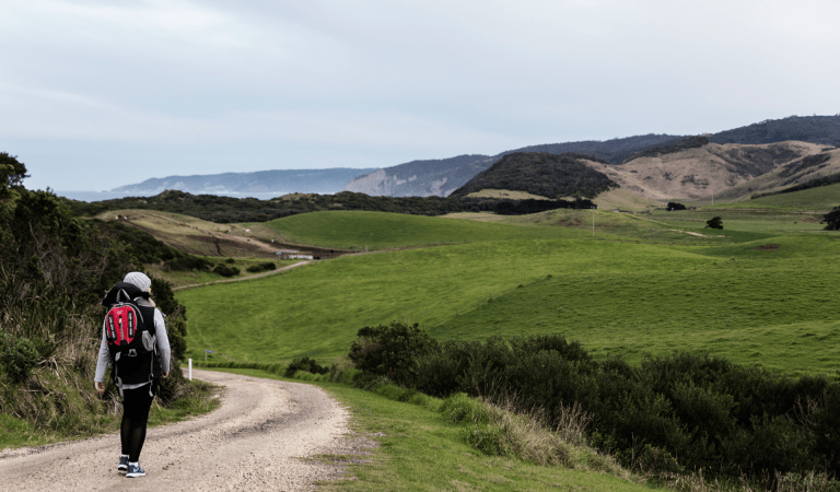
Short and Day Walks
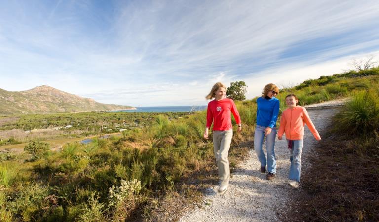
Day walks at the Prom
Walking in Werribee Gorge